Karoo Heartland, Tsitsikamma and Baviaans

To the people we met and the places we saw

On this long adventure, our footsteps crossed paths with many individuals. Thank you to all those we met along the way who warmly welcomed us into their homes, for showing us their families, their communities, their heritage. Our greatest gratitude goes to those who made this possible, for allowing us the opportunity to take this project as far as it is now. To the National Lotteries Commission of South Africa, Professor Rosabelle Boswell, Dr Denver Webb, The Nelson Mandela University Faculty of Arts, the Geosciences Department, and to the Arts, Culture and Heritage Department, a big thank you for all the contributions made to the project. Thank you to Jessica Thornton, Ryan Pillay, Rebecca Hayter, Andiswa Nzenze, Carl Pieterse, Phila Dyantyi, Christian Scallan, Bradley Ford, Nicole Collier-Naidoo and Sihle Sigwela for their contributions and commitment to the project. Without you, the project would not have been possible.

The second volume in the series is called the Karoo Heartland, Tsitsikamma and Baviaans. The influence of the indigenous people of this area, the Khoikhoi, plays a significant role in the names and in the practices of both tangible and intangible culture and heritage here. The round-trip journey of travellers allows one the opportunity to see the beauty of the interior regions of the Eastern Cape, away from the coastline. The open spaces and softer palette of earth tones create a melodic movement across the rocky, mountainous and vast terrain that allows one to get lost in the vistas.

Towns in the Eastern Cape are small and filled with character. Each locality is centred around a church and a few streets which makes it very easy to navigate for both locals and foreign travellers alike. Finding the eating and drinking spots where one can sample both local and indigenous cuisine is easy, and locals are always able to assist with directing and making one feel welcome.

The Karoo, which is filled with deep, calming colours – green, khaki, uplifting yellow tones of ochre, gold, with warm burnt red tones of orange, rust and all those in between – truly enlivens the imagination. This for any eye, whether seasoned to the vistas of the wider world or new to this part of the Eastern Cape, is enough to leave one quite awe-struck. Travellers will undoubtedly be surprised at the extent to which one can end up repeating the word “wow” seemingly ad infinitum on these notoriously long stretches of road!

The history of the Central and Southern Eastern Cape gives the traveller a keen sense of the pre-colonial and colonial eras, and the Wars of Dispossession and Resistance that once played out across this landscape. The layered history from different perspectives provides for a tapestry of opinions and deep, complex heritage. These heritages are contested, questioned, interrogated and their bones laid bare in the communities in which they take centre stage. This continual engagement with our history is essential in order for new generations to make sense of our past and our present. The condition of graves, memorials, monuments and sites associated with our liberation and other forms of heritage, illustrates what society deems relevant and ready to consume. The dissimilarity in the manner in which heritage is celebrated is evident across the areas in this part of the Eastern Cape.

The volume takes us through Joubertina, Hankey, Patensie, Tsitsikamma, Kareedouw, Baviaans, Willowmore, Jeffreys Bay, St Francis Bay, Steytlerville, Jansenville, Aberdeen, Graaff-Reinet, Nieu Bethesda, Cradock, Somerset East, Cookhouse, Middleburg, Rosmead, Pearston, Klipfontein, Camdeboo, and Glenthorn which were visited on this journey. Factors that play a role in shaping the character of each of the areas, include the people, the language, the means of production and the climate, were key to all our experiences.
St Francis Bay is a holiday village in the Sarah Baartman District Municipality, roughly one hour’s drive from Port Elizabeth. To many, the first thought that comes to mind when talking about St Francis is the iconic wave that was showcased in the 1960s surf movie, The Endless Summer. Today, Seals is the place to be for the who’s who of surfers from St Francis Bay. But St Francis bay is famous for many things other than just surfing, such as its beautiful canal systems that are surrounded by charming homes in a uniform building style: black roofs and white walls. The town is known for “keeping it green and keeping it clean.” In St Francis you will find the Seal Point Lighthouse and a penguin rehabilitation facility amongst the flora, fauna and wild waves. The circular lighthouse extends 28 metres from the ground to the balcony and was erected in 1882. Walking trails wind along the coast and through the Irma Booysen Floral Reserve. These serve as the perfect spots for whale-watching. Whales can be spotted in the area from May to late October with dolphins making a daily appearance swimming back and forth between the bays.

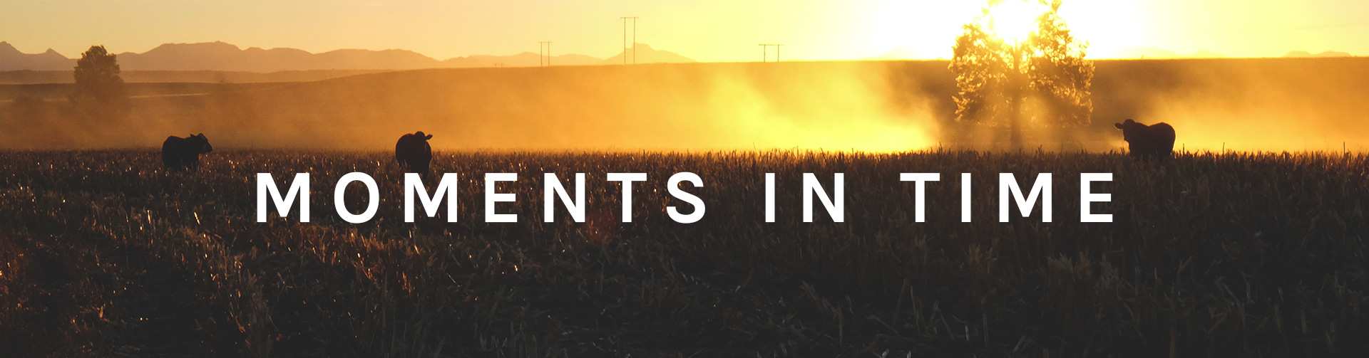
This popular seaside getaway is known for its surfing and sea-based activities. Perhaps surprisingly, Jeffreys Bay has more than one suburb, and one imagines it is perpetually filled with tourists. It is situated just off the N2 highway, about 75km south-west of Port Elizabeth and therefore very easily accessible. The road we started our journey on immediately coaxed us into the holiday mood: the open highway passes a huge new shopping development west of Port Elizabeth and ushers one out on a new journey. We start the music and a song by Sam Smith comes on and puts me into a sort of reverie, a state of reflection – the span of the road is enough for you to re-calibrate your thoughts.

This part of the Eastern Cape is different; green and blue dominate the vistas along the coastline, in contrast to the inland areas of the province. The smells differ too, with the enduring oceanic freshness and lush vegetation. The N2, which is well maintained, is flanked by the Jeffreys Bay Wind Farm. This project is one of the first and largest wind farms in South Africa. The wind farm site spans 3 700 hectares on which 60 wind turbines have been erected. The 80m tall, white wind turbines, with blades of 49m long, rotate a diameter of 101 metres. They look like huge children’s hand-held windmills. One wonders why the authorities could not have been painted the turbines in a colour. At this stage, they look space-like, as if they have landed from another planet. The energy they produced for Eskom, however, powers 100 000 average households.

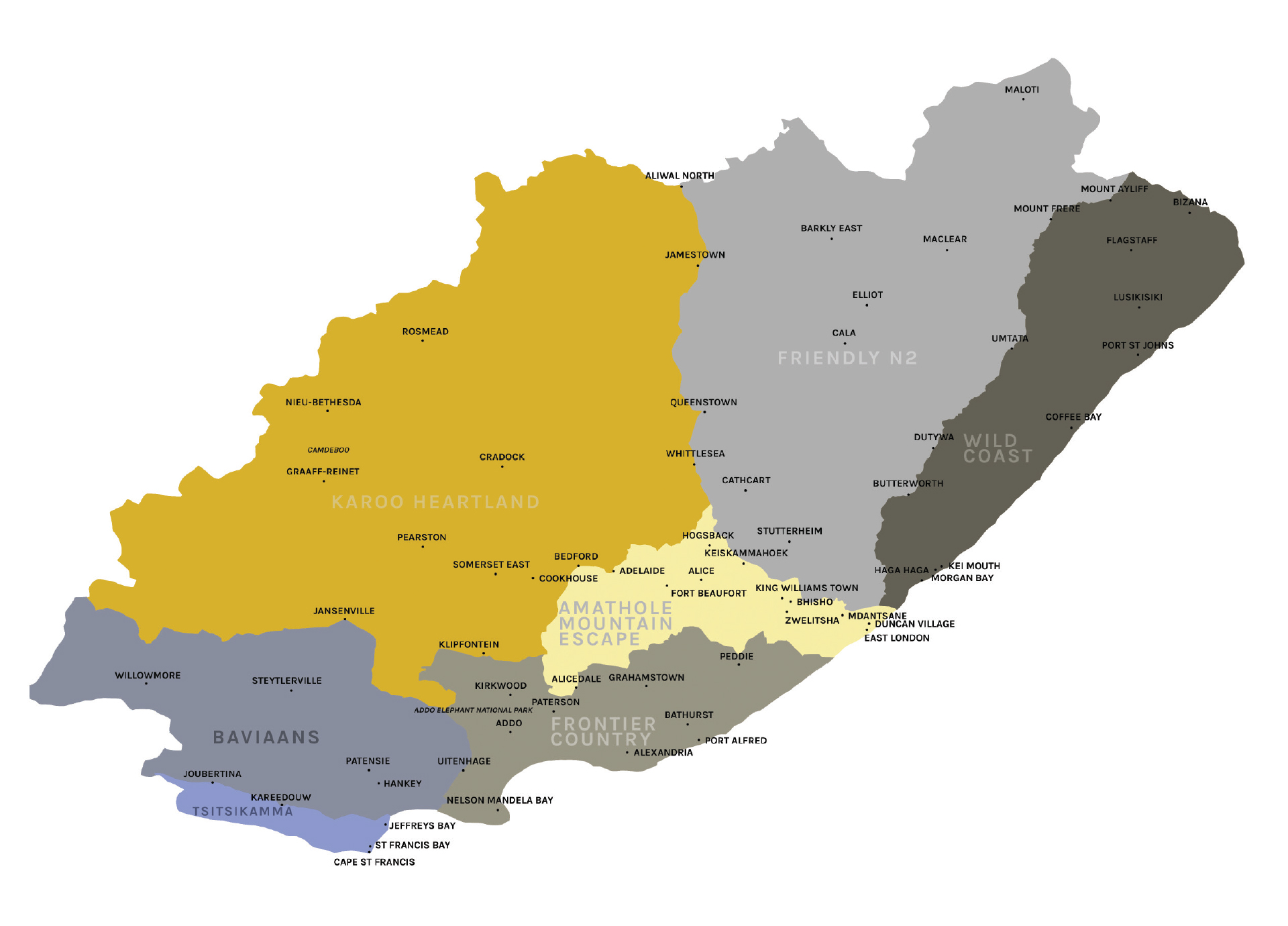
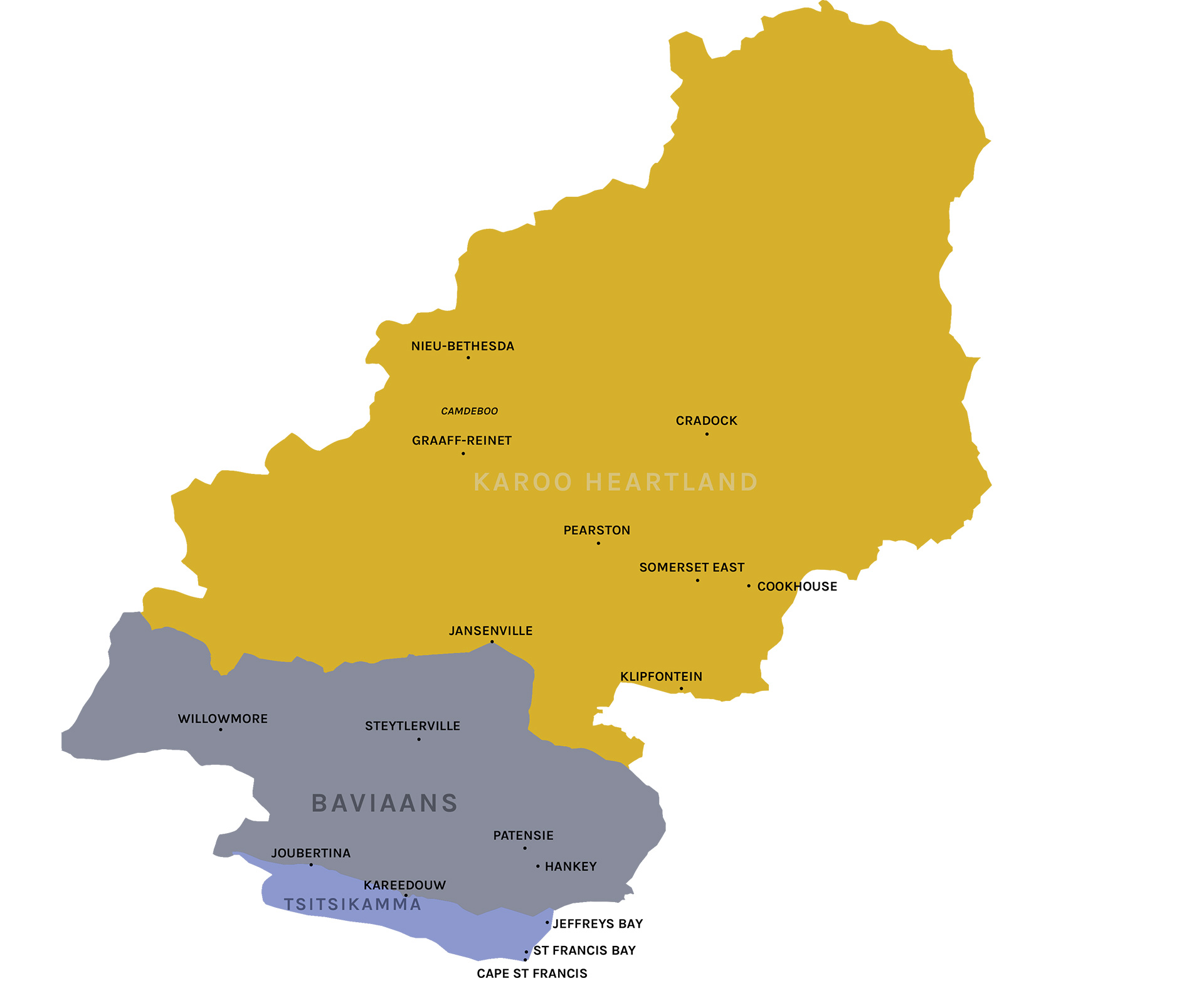
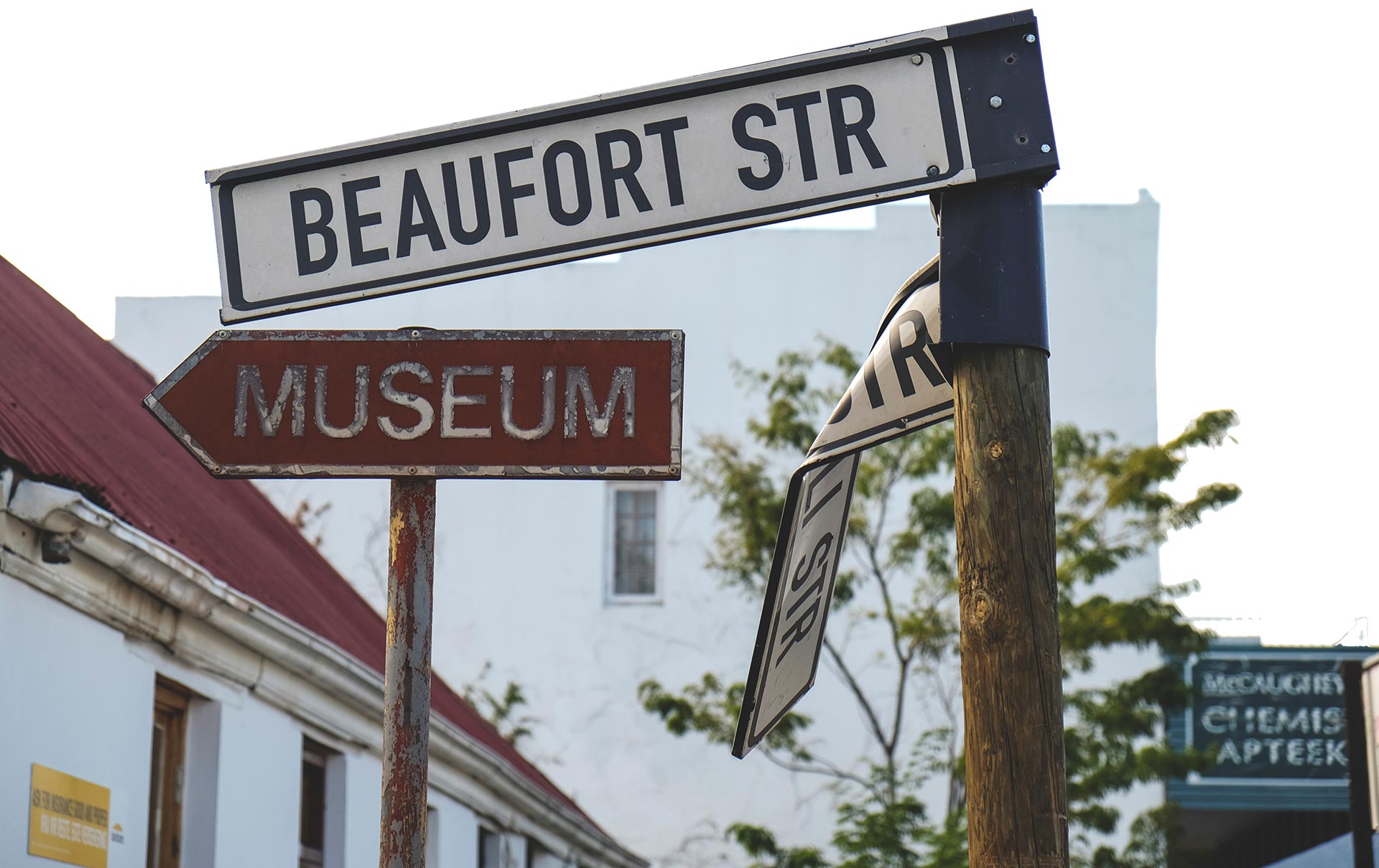
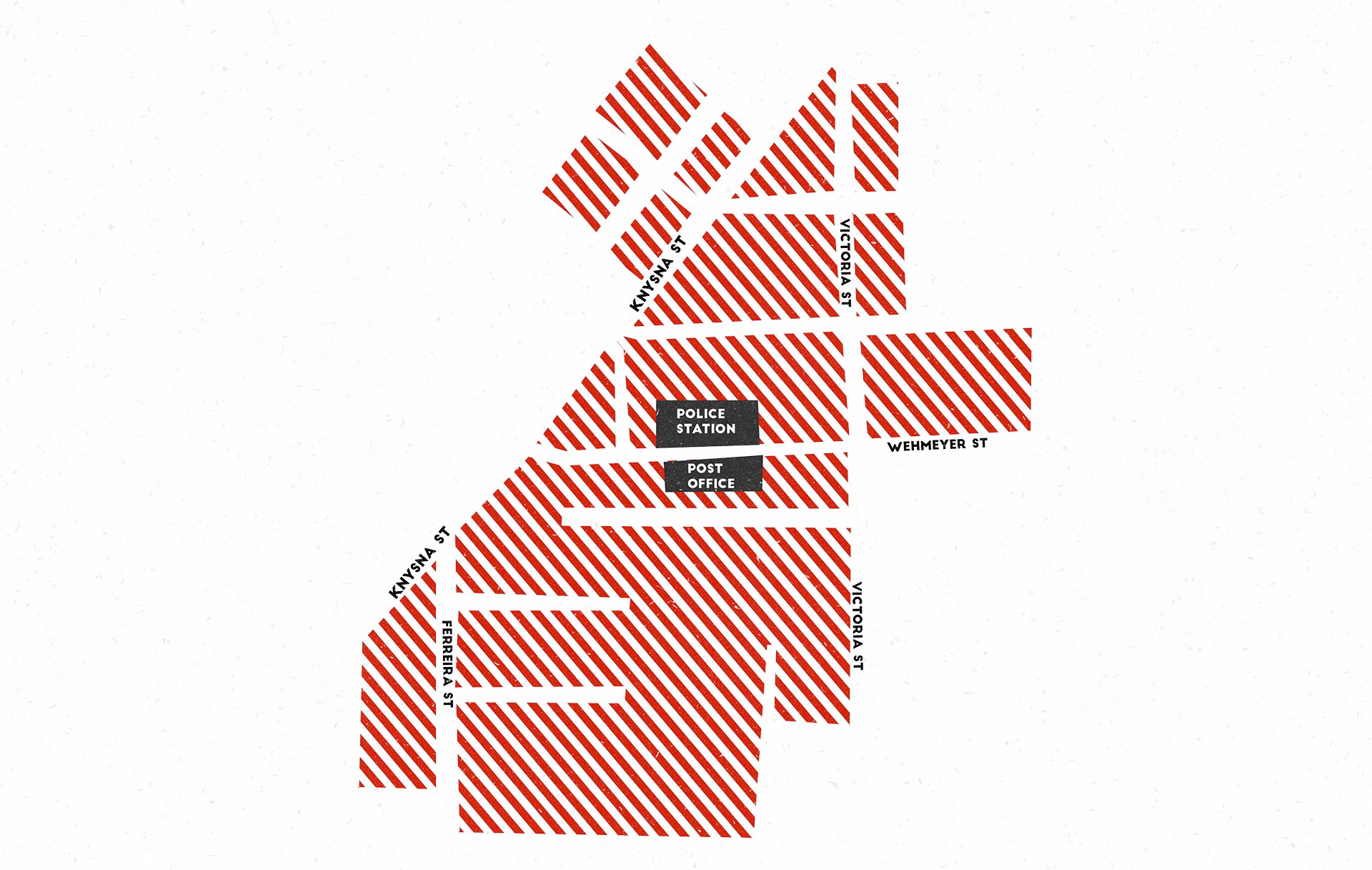
We drive further and take a right into Jeffreys Bay or J-Bay as it is better known, which is part of the Kouga Local Municipality of the Cacadu District. The questions around what is in a name are important and names can therefore be contested in some spaces. The stories told by locals in the town as well as a few people occupying important positions, lead to two renditions, the first of which is that the town was named after the senior partner of the firm Jeffreys and Glendinnings, which opened a store in 1849 where the town lies today. It is further believed that Jeffreys was the first person to have settled here. The second story proposes that one Captain Jeffreys was forced to land his vessel at the current Jeffreys Bay site. He then built a harbour and settled there, building a house which was known as the White House.

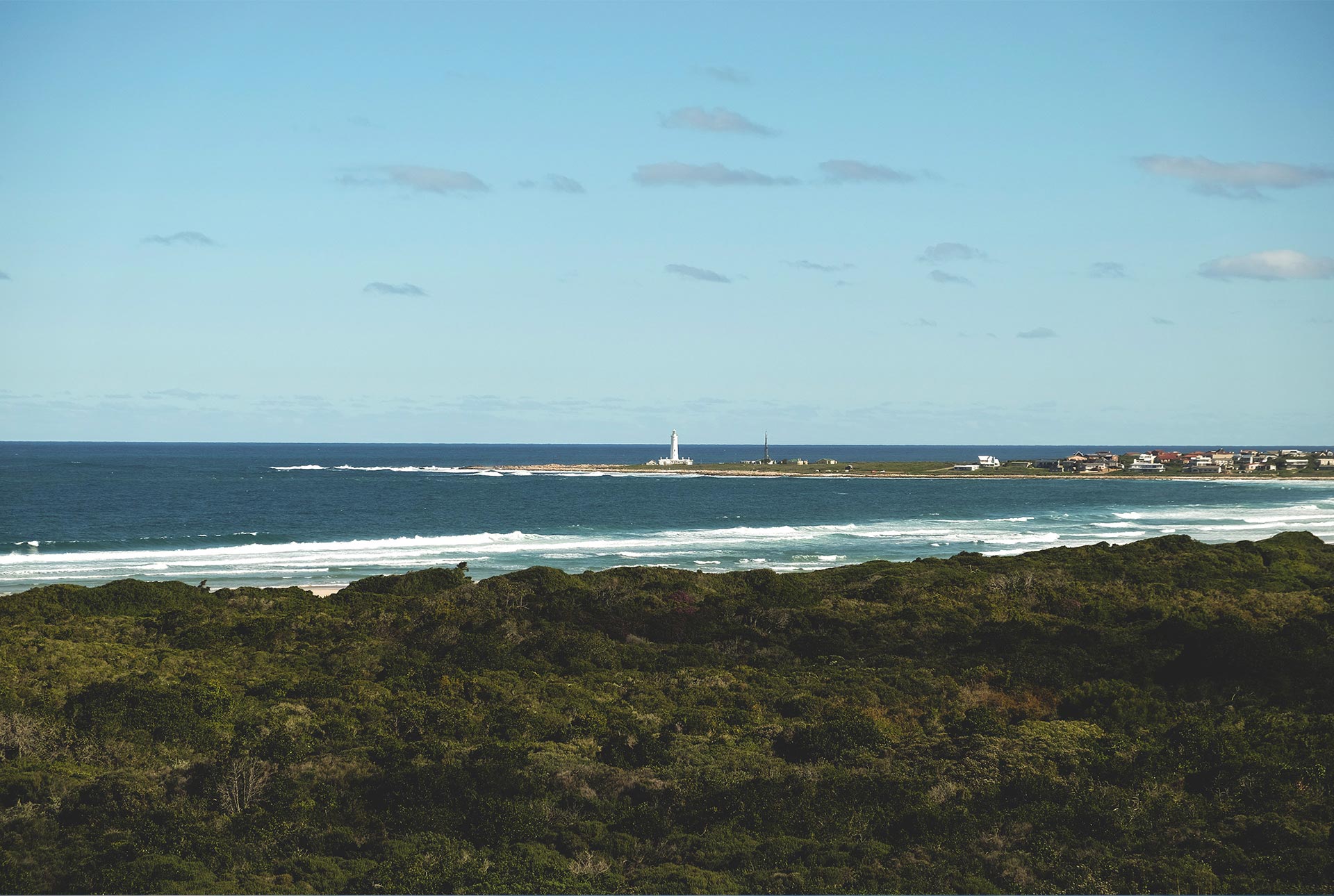
The early town was deemed a hippie hangout, and later earned a reputation for its sizeable waves and excellent surf spots. The Indian Ocean coastline along Jeffreys Bay offers eleven beaches one can visit and surf at. These include Kabeljous; Albatros; Inside Point; Impossibles; Super Tubes; Boneyards; Beach Break; Magna Tubes; Main Beach; and Kitchen Window. These beaches are a delight to surf at, walk on and enjoy. It is possible to walk from one beach to the next if you so wish.

I always purchase a new pair of boardshorts or swimwear with the intention of getting into shape and earning that ‘beach body.’ The truth of the matter is that the beach, the water, the surf and the ski are always ready for one, regardless of what sort of body one possesses. The beaches are filled with all kinds of people in society, cultivating the sense that the beach is owned by all and is not the playground of only an exclusive few. Public spaces and amenities here are accessible.

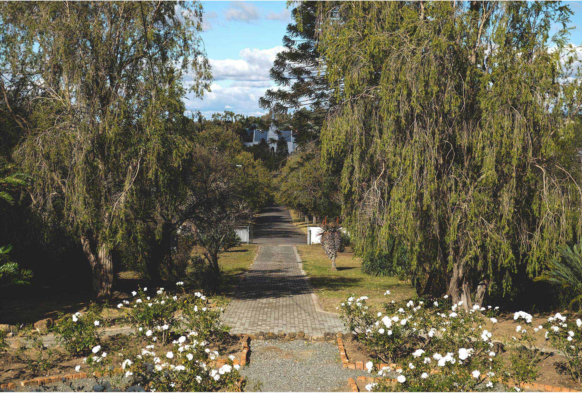
The entire area is rich in natural heritage, with the opportunity to relax, unwind, and go unplugged in three nature reserves: Kabeljous; Seekoei and Noorsekloof Nature Reserves.

The exceptional Kabeljous Nature Reserve offers a 2.5km coastline complete with forests, wetlands and bushveld. Many hikers are able to undertake quick hikes here, covering a few kilometres.

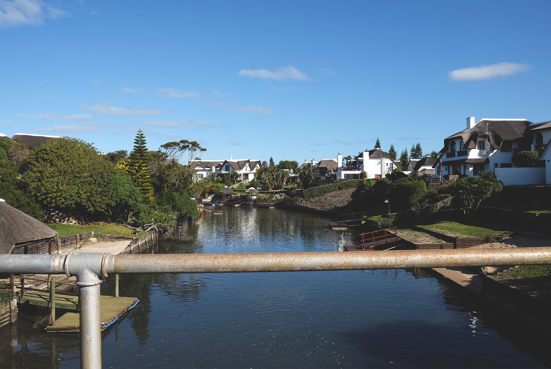
The Seekoei Nature Reserve is nestled between Aston Bay and Paradise Beach, which is a few kilometres away from Jeffreys Bay. The reserve is about 60 hectares in size and hosts the confluence of the Swart and Seekoei Rivers, forming an estuary. A large part of the reserve can be reached by boat. The guide tells us a small pontoon will be best.

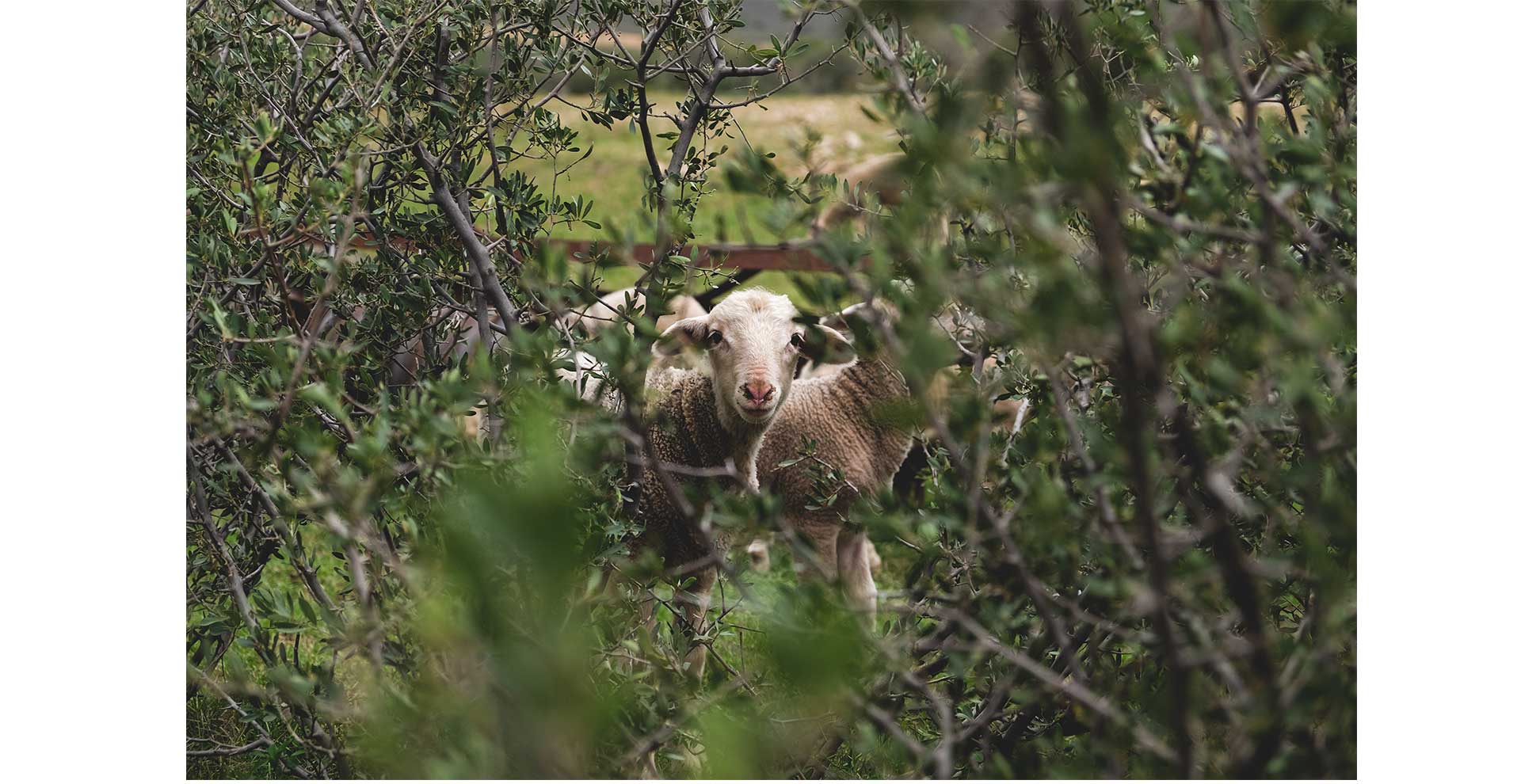
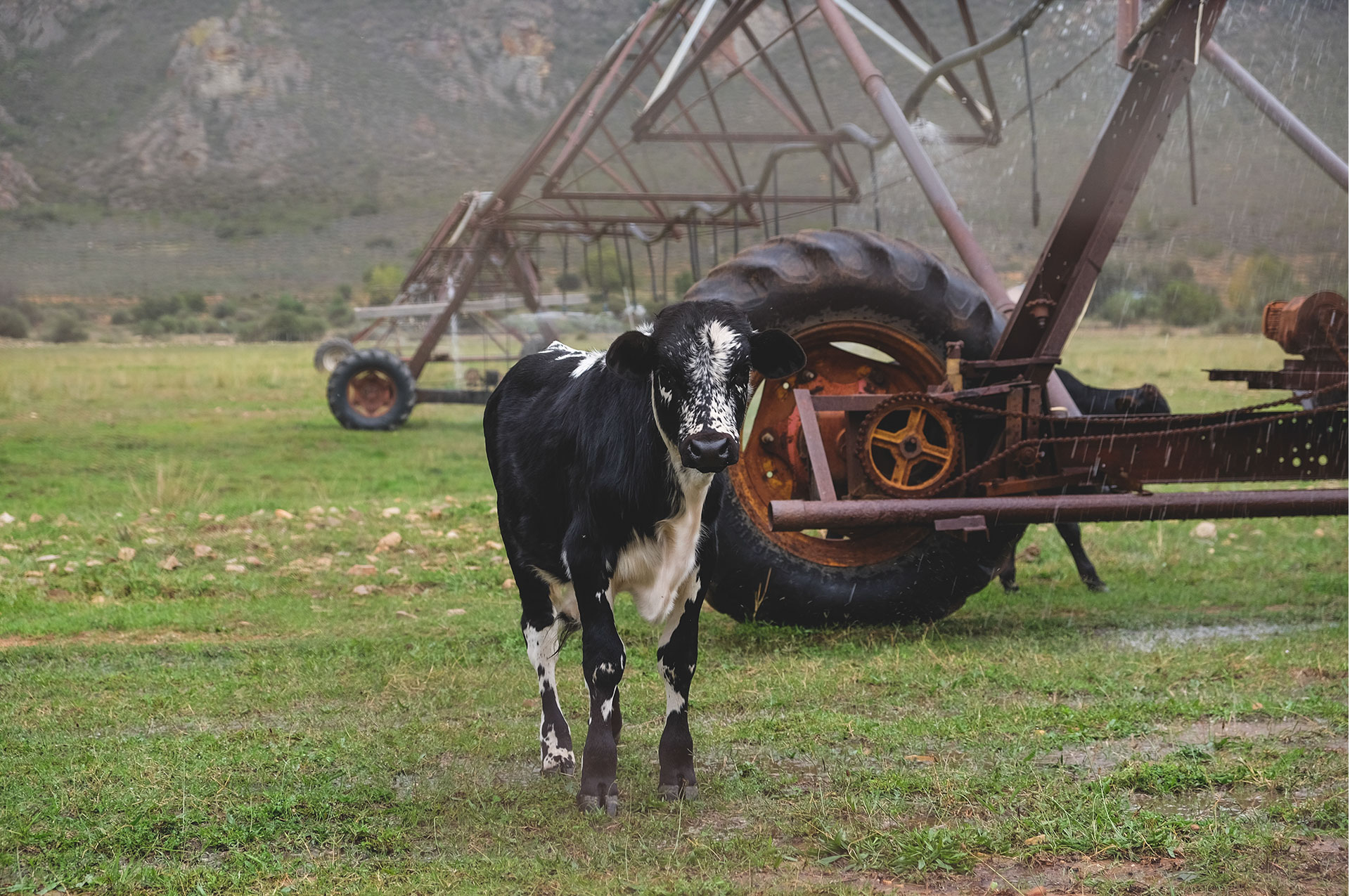
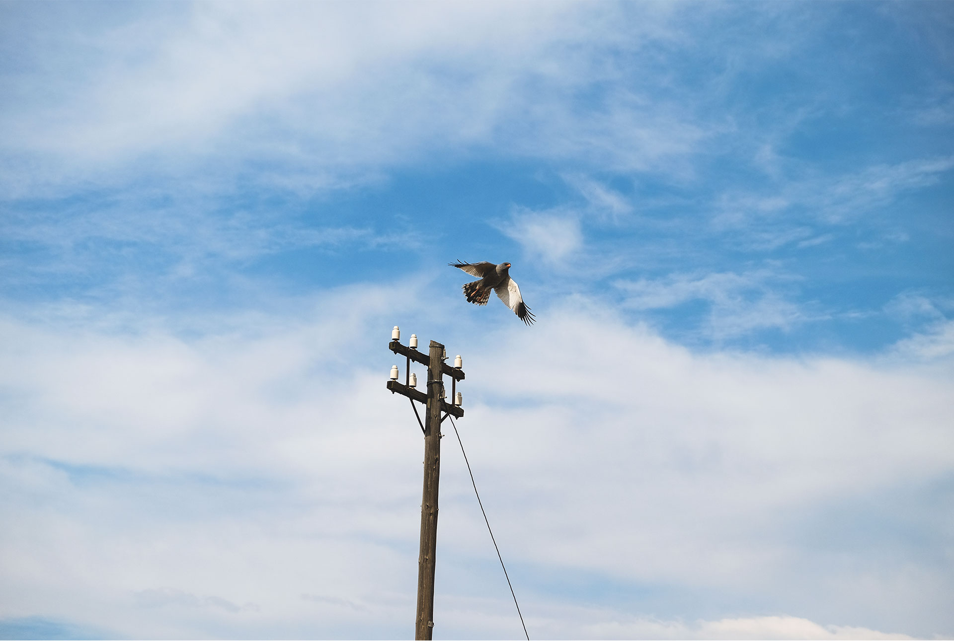
The reserve boasts over 120 varieties of birds, and one is almost certain to spot some wildlife, including duikers, bush pig, caracal, mongoose, porcupine, the ungulate tortoise, and the Spotted Genet (or Cape Genet). The magnificent Fish Eagle and the fascinating flamingo may also be spotted here. For foot travel in the reserve, there are a number of hikes and walking trails available.

The Noorsekloof Reserve is predominantly valley bushveld which is host to more than 50 bird species, including the Knysna Loerie, Knysna Woodpecker, and the Paradise Flycatcher. The reserve forms part of the residential component of Jeffreys Bay, acting as a green lung for the community.

Jeffreys Bay has many outdoor activities on offer and is a place that would delight the eco-traveller and the sports adventurer alike. I walk around some of the reserves and hear the mix of nature and its sounds coupled with those of the ocean. The two work symbiotically and allow me to feel energized, invigorated and alive. I turn the peak of my hat to the back and look into the ocean from my position within the surrounds of nature and marvel at it all. It seems in this moment that we as humans have encroached here.

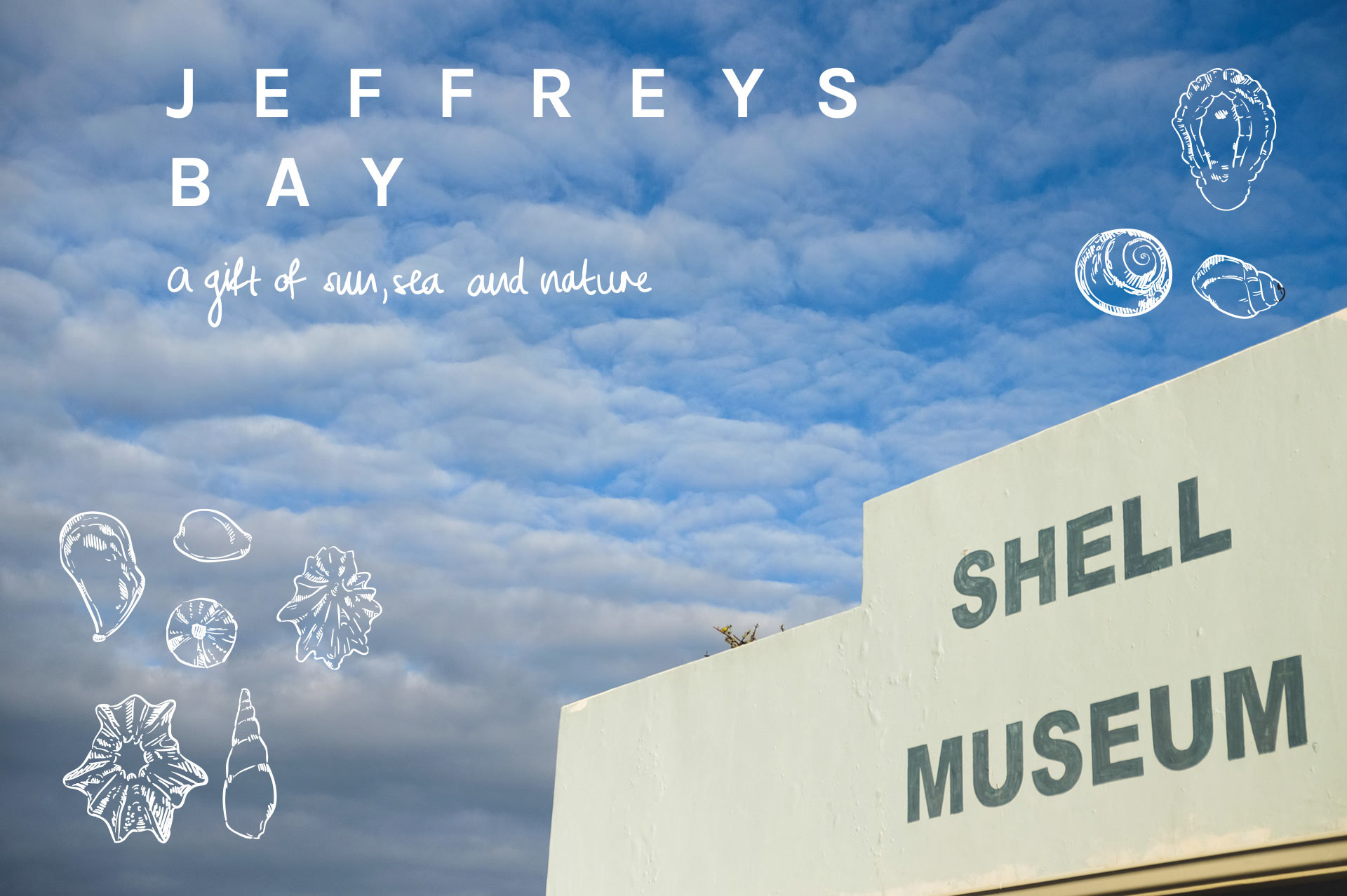
With the town being built around the ‘industry’ of the ocean, it makes sense that Jeffreys Bay hosts a Shell Museum. The museum has a collection of shells from Jeffreys Bay and international beaches and is one of the largest collections in the world. We amble through the assortment of glass cases enjoying some free iced tea given to us at a beach promotion stall outside. The shells are educating, with their fascinating names and sizes, with a few rare and celebrated finds. Poseidon, Neptune, Amphitrite and the gang might not be too happy that we have unbeached their treasure.

The Surf Museum presents a history of surfing and the legends of this sport who have been involved in J-Bay. The media clippings make for an enlivened set of archives that is easy to read and inspires one to ponder a time way back when. As you move around the museum, you see the evolution of the surfboard from heavy to light; from wood to foam and glass fibre. A hobby that has become a sport is personified with passion in the museum.

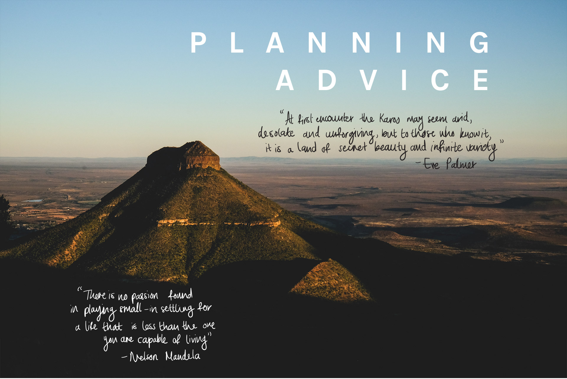
Jeffreys Bay is a town that has been built upon a love of the ocean, a love of freedom and a love of sport and nature. The space leaves one feeling refreshed, even festive, with all the natural elements that it has to offer.

Hankey is located in the Gamtoos Valley, along the R330 and the R331, adjacent to the former Avontuur railway line. It forms part of the Kouga Municipality in the Sarah Baartman District in the Eastern Cape. Coloured people make up more than half the population group present in the area. This makes sense since the area holds so much historical significance for the Khoikhoi people and has been re-named after one of its own daughters, Sarah Baartman.

Hankey lies adjacent to two smaller towns, namely Patensie and Loerie, each with its own history related to the church and development. At the centre of it all are the people and the movement thereof, which adds meaning to such places. I look around and wonder if the people who live here are happy and if they are included in the decisions affecting the space and ultimately the economy. It is one thing to be a visitor and another matter altogether to be a resident in the place. People here hold on to entrenched positions that have befallen their bloodlines over generations.

This town was established in 1862 and named after the Reverend William Alers Hankey. Hankey was an ex-banker and the secretary of the London Missionary Society. It should come as no surprise then that the man found the place tranquil, picturesque, and soothing to be in. The retreat-like place is quiet and hosts, along with Loerie, a camp on the west banks of the Gamtoos Valley. The area lends itself to the hipster, organic lifestyle that many city dwellers are now seeking refuge in. Considering that it is situated just over 81km from Port Elizabeth, the place could easily be a destination of tranquil oasis. Fresh air and fresh produce are calling my name. I think I could take a sabbatical here.

As we journey around, we find the Hankey Sundial. This is the largest sundial in Africa, and was erected in 1989 at the entrance to the town, right below the Vergaderingskop Mountain. It is 34.6 metres in diameter; the gnomon is 18 metres high and weighs a ton. It was built by Dirk Schellingerhout to commemorate the town’s 160th anniversary. This sundial brings up the question of time and the value of it. I walk around the sundial and wonder if time has changed conditions after liberation for most of the people in South Africa. The answer is rather glum to my mind – almost negative, though not without hope. This sort of space is for us perhaps an impetus to begin reflecting on innovations in both science and technology that can further advance the lives of many more people. This commemoration of the town should also signal that time is needed to effect change – positive change. Time to ponder in such a deep, reflective space on life, meaning and purpose, is meaningful and important work, more of which needs to be done. The founder of the place, a man of the cloth, certainly would have spent time in deep reflection all those years ago.

The first people in the space before it was known as Hankey were the Khoikhoi people and the Mfengos. Artwork and artefacts of the first people are to be found in the region. Some have been almost entirely forgotten, though attempts to celebrate them have been made. The stories of two such people have been highlighted, namely that of Sarah (Saartjie) Baartman and David Stuurman.

Her name, which seems to be used interchangeably with Sarah and Saartjie, reveals the possibility that the colonisers could have had an influence over the name by which we remember her today. As recorded in historical records, she was born in 1789 in the Gamtoos Valley and died in Paris, France in 1815. One may wonder what led to her popularity, or fame. What war did she win? Did she aid the soldiers in battle by giving them food? Did she outsmart a chief? No; none of the above. She was famous because of her body and, in particular, her very large buttocks. She was taken to France where she was paraded as a spectacle, a feature to view, in a number of forms, for the voyeur et al. Here she was known as the “Hottentot Venus”. After she died, parts of her anatomy were displayed in the Museum of Mankind in Paris until as recently as 1974.

On Women’s Day, 9 August 2002, Baartman’s remains were exhumed in Paris and returned to Hankey, where she is now buried. This process of reclaiming her as one of the people from the area is significant in declaring that such parts of our heritage be taken seriously. It is a signal that the stories we tell about our nation must have an inclusive nature. Different indigenous groups have a place in history and it is essential to tell the story in ways that illustrate that South Africa is made up of many such cultures and population groups. This diverse cultural heritage allows people to think of ways of being that are affirming for themselves and others. Humanity is humanity. Humanity should beget humanity.

The Sarah Baartman Centre of Remembrance, the Sarah Baartman Human Rights Memorial and the Khoi San Heritage Route have all been established to commemorate the life of Sarah Baartman and the Khoi people.

Stuurman was a Khoikhoi man who was jailed on Robben Island and had tried to escape a number of times. He was born in the Gamtoos Valley, and this is regarded as his home. After repeated attempts to escape Robben Island, Stuurman was sent off to New South Wales in Australia, which was a penal colony at the time.

The spirit of David Stuurman was returned to the area when officials went to Australia to perform a ritual to bring his spirit home.

The monument was erected in 2002, for the eight freedom fighters that were killed in 1986. The 80s in South Africa were marred with resistance violence, and there are many spaces that hold such history. Each of these spaces are reminders of the past, but more importantly a lesson reminding us where we do not want to go back to as a people. As a traveller, this may be seen as commonplace along such a journey.

We travel further on the R331 to find a small citrus town called Patensie, also in the Sarah Baartman District. The name is of Khoi origin, meaning ‘the cattle-resting place’. These names point to the original people who first lived here. I wonder as I read this, if many people who live here, or even visit here, take cognisance of this meaning, how “eyes wide shut” are we as we operate in this world? Patensie, which was fist a privately-owned farm, was given to David Kayser Jnr in 1852. It was later, in 1858, that the town of Patensie was formed. Citrus and tobacco are farmed in the area, and today, the biggest company in the area is the citrus co-op, which is called PSB.

I think back to a time where smoking cigarettes was seen as cool. Some of the farms in Patensie grow tobacco and continue to supply a strong market. The developmental spirit in me thinks that it provides employment and other such spin-offs for the community and the rest of the Baviaans. My worry is quelled to a satisfactory point that I can manage to take in the green and orange around the place. The citrus season is in full bloom, with harvest time falling between the months of April and October. In addition, farmers in the area also grow vegetables and chicory, and there are game farms in the area.

The development of the town of Patensie was sped up by the construction of the Kouga Dam in 1967, though it was first called the Paul Sauer Dam. The dam is famous for its state-of-the-art engineering: the first double-arched dam engineered in South Africa. The dam is 82m high and has a capacity of 128.7 million metres cubed. The dam also has flood-control sluice gates which are not being used in these times as the region is suffering with water shortages. The dam was built to supply the Loerie Dam and its purification works, which supplies water to the Mandela Bay Metro, including Port Elizabeth.

The resounding sound of the water that gushes out of the cement pylons which stoically form this bridge reverberates into echoes. The continuously pounding water reminds me of forces that are larger than our human lives. There is a quarrel between the water in itself: that gives life, but can also cause life to end. The forces of nature are all represented in the heat that envelops us while we observe the water, making me want to dive into the dam.

The natural heritage in the area is abundant with rich flora and fauna. Patensie borders the Baviaanskloof Wilderness area. The majestic Cockscomb Mountains frame the area.

The flora in the region and the town are diverse, there are at least five vegetation types and more soil types. We are told that over 1000 plant species grow naturally in the area. Upon reading up a bit more about the region, the four types of growth areas in existence in the region are the Afromontane Forest, Fynbos, South Coast Renosterveld and the Little Karoo Shrublands. The diversity and the intensely contrasting textures and colours create a vivid picture and add resonance to the imagination. A rich tapestry of natural beauty abounds in this region.

The fauna in the area is evident also, with a programme to re-introduce some species: eland, red hartebeest, buffalo and the Cape Mountain Zebra. The baboons can also be spotted. The Dutch word for baboon is “baviaan,” therefore the adjacent area to Patensie is called the Baviaans.

The Ripple Hill Hotel is a quaint, white and green establishment on Paul Ferreira Street in Patensie. The restaurant and pub provide a place where locals and tourists can meet. In addition, one can enjoy Baviaans hospitality at the local “Padlangs” restaurant. The word “padlangs” is an Afrikaans language word, which means “along the road.”

Each area is different, but there seems to be an undercurrent of sameness which explains why these various parts of the Beyers Naude Municipality have been woven together. The former anti-apartheid activist, who fought for the liberation of this country, would be proud of the sense of inclusion, the bringing together of differences and similarities that these parts of the Great Karoo personify.

We set off on our journey form Port Elizabeth not completely sure if our hired sports utility vehicle (SUV) would weather well, remain unscratched and prove strong enough for the hilly, dusty and boulder-like terrain of the region. Most of the roads are tarred, well-lit and easy to navigate with effective sign-boarding. The arterial roads are also comfortable to drive on. However, it is when one goes in search of the magic that lies off the beaten track, that the road-handling requires more concentration and greater care.

The N10 road could perhaps be personified as a highly reflective, deep-thinking partner who allows you time to debate, mull your thoughts over and reformulate your response. The stage of the N10 is dressed with wings of mountainscapes and vistas of hills that are flanked by Slagtersnek, which, translated into English, would be “slaughter hill.” This was a site where Afrikaner rebels against the English were captured for resisting arrest after a farmer, Frederik Bezuidenhout, was repeatedly accused of ill-treating a Khoikhoi worker in 1815. Bezuidenhout was shot dead in the fracas and members of his family and community decided to avenge his death. This lead to a stand-off between the party and the British. Some of this party ultimately handed themselves over, but Bezuidenhout’s brother refused, also resulting in his death. All of this happened at the Slagtersnek site. Many of the rebels were hung after a trial the following year.

On 9 March 1916, exactly 100 years after the execution, a monument was unveiled on the spot where the hanging took place, on the N10 south of Cookhouse. As we travel further along the N10, I notice a sign fixed to the dashboard of the car, which says: “treat me as if I am yours,” and I wonder whether the entire sordid history of Slagtersnek could have been avoided were the dashboard sticker representative of a widely held credo.

Some kilometres further on from the site, we arrive at Klipfontein (33° 9′ 5″ South, 25° 28′ 41″), which is a quiet, dusty, unpaved, street hamlet of a dorpie. The desolate small village has a mix of prefab and brick houses. As we drive through the almost u-shaped road we come across a mobile clinic and a school and we realise, like the title of the Athol Fugard play People are Living There, indeed: people are living here! The local school received books from a donor in Port Elizabeth to encourage students to imagine and re-imagine possibilities. We all know that education is the greatest leveller and we hope that reading can allow the youth to turn their thoughts from the corporal to the cosmic.

We stop at a shop owned by a foreign national and venture in to be met by some resistance as opposed to being welcomed. The man, who wished not to give us his name, says that the area is made up of farm workers and people working in a nearby factory. We purchase some of the fresh fruit from his store and are engaged by the neighbours standing in their yards behind wire fences. As we walk closer some dogs bark playfully at us and I, not fond of being barked at, bark back at the dogs to much laughter.

The man, who introduces himself as Jacob, is ably challenged and tells me I have no business here. I am shocked and continue to ask why; he says that they do not need another person asking them questions. I am left wondering what questions were previously asked. I assure him that I am mean no harm and explain the purpose of my travels. He walks away, however, and turns his jazz music louder. A fellow traveller shares that this is ‘elevator’ jazz music. Whatever version of music it is, Jacob plainly showed us how liberated he is.

The community has two distinct areas separating people’s living spaces. We notice that there is a farm township and an urban rural township. One of these developments have been locally named Masela. This is an isiXhosa term which makes reference to thieves.

Klipfontein is made up of a variety of different cultures despite being a small place. I think this is perhaps the recipe for successful diversity as you have to get along with everyone – if not, it results in boredom and even self-exclusion.

The area, which is mostly agricultural, has vast plots of farming land. The livestock farmed here includes stud cows, which originated in the rugged Marche and Limousin regions of France, known for extreme summers and winters. With the climate in this part of the Eastern Cape, the cows breed well and thrive, adding sustainable employment to the community of Klipfontein.

As we travel along the R63, I see contours of electricity lines connected in parallel. We wonder amongst ourselves whether the connections allow people to be more united and yet different in their diversity and respect for each other as we travel this road. Like electricity, there will always be some resistance, leading to the current effects of energy and power around the world. This momentary personification of power is all put to a stop, however, when I arrive in Cookhouse. As we travel along the road, I notice us passengers seem to concentrate on one side, and I contemplate what makes the beauty of travel so new every time. Each occasion of travel becomes either sensuous or austere, often surprising in the emotions each instance evokes. I look around Cookhouse and see very few people but I am immediately struck by the silence of the town, in stark contrast to the busy national road that brings food, goods and people. The village is small and lies 24km from Somerset East.

Differing stories are told by the residents who pass by and whom I respectfully stop to enquire about the naming of the place. According to local legend, the town earned its name thanks to a small stone house that was once used to cook for troops that passed by in the 1700s. I look around at what forms part of the built environment in the town and, spotting the train station, I imagine the occupants of this ‘cookhouse’ providing food for train builders.

Along the side of the road we find the Fallen Heroes Monument, which was erected in recognition of the vital role played by our people in the fight against Apartheid, in an effort to salute and remember the names of those heroes and heroines who laid down their lives for the freedom of South Africa. This monument was opened in 2007, and like so many monuments we have encountered thus far, it is stationed behind a fence and remains inaccessible to the public.

Invariably, in all the towns we have traversed in the Eastern Cape a church is to be found, and, more often than not, it is large and built in a time when more people worshipped in the space. These structures are signifiers of an era in which the architecture did not reflect the people who lived in the area and inhabited the space. The NG Kerk found here is a large structure that forms the centre of the small town. The street names in the area recall those of streets in Tshwane, formerly known as Pretoria. It makes one wonder whether the people here did not have any names of their own with which to adorn the few streets that the town had. Culture, which is not one’s race, should surely have played a role in the naming of spaces and places. However, upon brief reflection of the time during which this town was established, one could say that the dominant cultural norms of this era were here firmly entrenched. Further evidence of this town’s historical character is found in a poem by Port Elizabeth-born poet, Chris Mann, titled Cookhouse Station. The opening stanza calls for the reader to visualise the once-bustling station and all that it offered: the Christmas beetle; the beggar; the migrant worker; the smiling policeman; the widow; the girl whom trainee soldiers whistle at; and also the shades of the people who once lived there.

We arrive at Somerset East, and I am immediately struck by the division of the town into its different areas, visible as soon as we turn off the R63 within the Blue Crane District. The town, which was established by Lord Charles Somerset in 1825, today has a population of nearly 20 000 people. The predominant language is isiXhosa, followed by Afrikaans. Few people here naturally speak English, but it is understood. This part of the Karoo is also known to have had people of the Ganakwu population group, possessed of a blend of Black African and Khoikhoi heritage.

The area after the second bridge is called Aeroville, a name which makes one wonder “why that, rather than Crunchieville or Kit Katville?” This area is filled with RDP homes built by the government. We drive through a part of the town called Old Location, where a man once won the Lotto and used some of his winnings to pave the road.

I consider myself a trans-language South African, ready to speak the language of the area, or attempt to explain myself in a way that is meaningful to the person I am conversing with. Here, I switch to Afrikaans and isiXhosa and receive a warm reception from people and I gain answers to my questions that we certainly would not have received had I spoken in another language.

The town has a picturesque backdrop thanks to the green and brown Boschberg Mountains, which are stately and wondrous to witness. This vista, which frames the town, makes me feel as if I am breathing in the freshest air, filled with possibility: of stumbling upon new interests, embarking on new adventures and meeting new people. These mountains are depicted in the Robert Jacob Gordon Journals, and it was rumoured that unicorns were seen on the Boschberg.

Alas, the air is cold and propels me back into the car with haste. On the main road, we hear classical gospel music blaring from a closed church, one tune recalling Charlotte Church from Wales. The next song is the South African legend Rebecca Malope’s Moya Wami. This song exclaims that the singer will place her faith in God alone. I am taken back to an urban city, where such activity is commonplace, to my recollection. It is evident that a belief system is needed everywhere and the traditional influence of local worship through praise is alive.

The main road is often filled with 4×4 vehicles, no doubt carrying explorers off on various adventures. Somerset East is in fact a hub of adventure, in large part due to the Boschberg Nature Reserve, which has a few hiking trails. This natural heritage can be enjoyed through day hike offerings and overnight facilities in the form of huts. The area boasts a number of dams with nutrient-rich water that, in the Glen Avon Waterfall pools for example, is able to sustain both rainbow and brown trout. How cold the water might be at this time is a big question – more important, it seems, than my ability to swing a rod and catch some trout.

The Old Wesleyan Chapel now houses the Somerset East Museum. Also known as “The Old Parsonage,” it was built on 23 May 1828, became a church in 1833, and is now an Educational and Nature Conservation Centre. The vintage house is host to a grave buried beneath one of the main front rooms. The house is a museum replica of the time that it accommodated men of the cloth as residents. The past seems to reign true in an eerie way here as one makes one’s way over the creaky floorboards of the house. The Somerset East Museum host three parts, the Old Parsonage Educational and Nature Conservation Centre, the Imithi Yesixhosa exhibition, and the Slagtersnek exhibition.

In contrast, referencing a different period of liberation fighting, is the Forgettery Exhibition, which is inspired by a poem written by AB Pike. This exhibition remembers struggle heroes such as Jakes Gerwel, Norman Bantu Ngcipe, Walter Benson Rubusana and Frederick Emmanuel Hufkie. This exhibition needs its own space that is open and accessible to the public. I am not certain how many people from the local community visit the exhibition. The rooms, painted purple, leave a deep contemplative and sombre mood with me as I read the stories of the four men who fought for liberation, in fact fought for me to be able to stand in this very space. Ironically, the museum holds old Pretence Hall published Law Journals from 1954.

A grave belonging to the oldest woman in town is also to be found here: that of Ouma Dora Dotyi Jacobs (1880-2003) who lived until 122 years of age. It was a sign of respect for the town authorities to have her body placed close to the museum. The road leading up to the museum harbours an old building which seems run down and upon closer inspection turns out to be an old Voortrekker Monument Building. This building was opened in 1990, the same year Madiba, Nelson Mandela, was released from prison. That must have been an interesting time in a small town, as much as it was in the wider South Africa. A War Memorial is housed in the town to commemorate the fallen heroes of World War 1 and includes the names of local soldiers who died in the SS Mendi. The ripple effects of the latter event are brought alive in a poem written in 1943 by SEK Mqhayi, titled Uktshona Kukamendi – in English, Sinking of the Mendi. The town also plays host to the Biltong Festival as well as a Spring Rose and Flower Show, signalling the success of rose cultivation in this area.

The Walter Battiss Art Gallery is in the oldest part of town. It was once used as a colonial officer’s lodging. The artist was born on the 6 January 1906 in Somerset East and died in 1982 in Port Shepstone. Some of Battiss’ most famous works include Symbols of Life; African Night Market; Coco de Mer; and Seychelles. He is also well known for his Fook Island, which is his island of the imagination. This island is an amalgamation of the many islands that he had visited on his travels. Fook Island has its own alphabet, driver’s licence and passport, among other artefacts. Battiss is known to have stated that the reason he created this island was “to make real the island that exists within all of us.” This also represents a reaction to the Conceptualist Art movement.

Today the museum, owned by his family, is a homage to his work and hosts the largest collection of his art. The place is interesting and seems somewhat obscure considering that, stationed as it is in a small town in the Karoo, it plays host to the work of a world-renowned artist. This signifies that greatness comes from anywhere and can be cultivated anywhere. May the example of Battiss be a source of inspiration to the many creative boys and girls in these remote towns and dorps alike.

The transition between small Karoo towns from Somerset East to Pearston manages to draw me deep into contemplation very quickly. It is amazing how a few minutes outside a town, the green, yellow and brown tableau moves one to reflective thought, and the voices of the hills seem to talk directly to you. It is such a rapid juxtaposition to the realities of the social issues that are part of the face of the towns, where clear divisions of established past privilege are rife, as are more recent attempts at creating a new life.

The fault lines in these small towns are entrenched! Attempts at transformation are only evident in deliberate, formal spaces – a wing in a museum, a name-change or other such superficial changes. I am certain that people over generations have wondered whether they too had the right to enjoy the land as some do, over others. Who, one is driven to wonder, is more human than others are? Traveling through this beloved Eastern Cape brings to the fore such conflicting realities, leaving disturbing questions and much frustration over the simplistic debates amongst people whose solutions need to include more in society than a few ruling elites. Let the rant stop!

A newly-paved, single-carriage road that leads one to Pearston, takes me from the town to the dorp. The weather seems to exacerbate my mood of deep brooding over blatant social inequalities with its dark clouds looming, but none the less with an unseen benefit – a silver lining. The isiXhosa saying, “Inkungu ilala kwii ntaba nge ntaba” helps us understand that misfortune is universal and that it befalls us all at one time or another. The names of the places on the way to Pearston provide a glimpse of hope, such as in the place called Prospect; or describe the area or natural heritage, such as Bloukrans and Kliplaatberg.

Upon arriving in the dorp of Pearston, one notices how so many of the buildings in this quiet, dusty place have walls that are painted white or the colour of the sand. The children gather round to play near the shop or push the rim of a bicycle wheel with a stick and race against each other. We find an Ossewa Trek Memorial which was established on the 22 September 1938 in the yard of the NG Kerk. It reads, “1838 to 1938, Ter Gedagtenis aan besoek van ossew-trek”. It consists of a cairn – a pile of stones, placed in a dome-like structure held together by cement. This ritual of placing stones is seen throughout the Eastern Cape, and we too placed a stone at Biko’s grave in Ginsberg.

The Ossewa Trek, which was the movement of the Afrikaans people from the Cape to the Free State and the Transvaal, was marked by many battles and hardship. This site in Pearston was one of the places that the ox-led wagons passed through.

Along the main road of the dorp, we find the Ernst Van Heerden Library. Van Heerden was a poet and academic who matriculated at Grey High School in Port Elizabeth, was born in Pearston in 1916 and passed away in Johannesburg in 1997. He is highly regarded as a literary legend and deep thinker who made a valuable contribution to the literary forms of poetry and autobiography, as well as to literary and travel journals, amongst other writings. It is therefore interesting that the library is named after him and we hope that the spirit of Van Heerden can inspire a new generation of children to also be proud of their heritage and write in such powerful ways in their own mother tongues. Camagu!

The library is small and occupied by a number of children huddled around a few computers. There are also a handful of people who are here on a break from the Expanded Public Works Programme, who build and clean roads. There are two rooms, divided into adults’ and a children’s sections; fiction and non-fiction. The reality that South Africa remains a developmental state is undeniable when we view the condition of public facilities, which leave a lot to be desired. The library, which here serves a number of purposes, could be doing so much more. How, one is left wondering, does it inspire reading, literacies and ultimately imagination?

Pearston has two townships, Khanyiso and Nelsig, both of which boast an abundance of recently-erected RDP homes. Millennium Park, which was established in the year 2000, is also a part of the townships. Was this park meant to signal hope at the turn of the century, to bring to realisation the dreams of the people? The area has three schools, which one could take as a sign that hope can flourish here.

We leave the dorp, look out over the Coetzee Mountains, and wonder aloud whether what we are viewing is some sort of copy and paste application, as all the mountains in the vicinity look the same. The road seems as if it is but a late addition to the landscape, as if placed there by aliens. Science, engineering and all the other technologies underpinning these roads fall into a silence, their contribution to the ease of the drive seemingly imperceptible. We navigate roads such as these without any thought sometimes of the what, why and how it all came to be.

Each of these towns seem the same, almost as if one is but a replica of the other. Yet each town bears its own peculiarities either associated with produce, farm production, or perhaps linked to an artist, poet or sports personality. People are either proud of the personality or bear no relation to him/her whatsoever. One wonders whether the designated personality is inclusive of all the people and whether all people can see themselves in the work of that person.

Small towns awaken an uncomfortable awareness of isiXhosa culture and history being a kind of add-on and not the natural discourse of the place, irrespective of the dominance of this cultural grouping in the province. In addition, the ride away from Pearston also brings up the perception of what is socially constructed as coloured, with the role the San and the Khoikhoi people play as the first inhabitants of this land. How are their heritages celebrated and foregrounded?

We continue on the N10 to Cradock and journey through Patryshoogte, Bedford, and Kolskraal, which lies 60km outside of Cradock. As we trek through, I see places called Uitsig, Daggaboersnek, Witbos, Spekboomsberg and the Department of Agriculture’s Experimental Farm. The rolling hills appear to want to whisper their stories to passers-by, to produce tunes polyphonically. Just then the quiet of the wind creates the sense of a still slow centre that makes one question the nature of this space, leaving one to wonder and marvel over how people lived here before.

Cradock was founded in 1813 for farmers who migrated here along the banks of the Great Fish River. The area is predominantly concerned with agricultural activities, such as cattle farming and wool production. Many settler families originated from here, acquiring farmland that remains by and large in family hands today. More settler influence is noticeable in Market Street, with old Victorian cottages which are now heritage sites.

We enter Cradock and are met by a dry, camouflage-coloured landscape which creates a sense of being a repository for deeply buried narratives, the hunting down of which could add years of listening to any traveller’s journey. It is June 16 and we are in Cradock on Youth Day: the day our nation commemorates the students who were gunned down in the 1976 protests against the use of Afrikaans as a medium of instruction. The Cradock Four Gallery, which falls within the Inxuba Yethemba Local Municipality, forms part of our Liberation Heritage. This gallery, which exhibits Xhosa beading and an art display, was opened in 2006 and is painted in the Graaf-Reinet style, with its green roof and white walls.

The Cradock Four are schoolteachers Matthew Goniwe and Fort Calata, railway worker and unionist, Sparrow Mkonto, and activist, Sicelo Mhlauli. In June of 1985, the Apartheid security police abducted the four and murdered them in cold blood. Their burnt bodies were found later near the Port Elizabeth suburb of Bluewater Bay. This moment served as a turning point in the history of South Africa and a State of Emergency was declared on the same day as their funeral. The story of these struggle heroes from a Karoo town informs the narrative of unified resistance that spurred many others on to fight for the state of freedom in which South Africans find themselves today.

The Great Fish River Museum is a small building in Commissioner Street. It accommodates the early history of ‘the Eastern Province pioneers’ from 1840 to 1900. The space houses various transportation systems dating back to that era. The way of life of the settlers is depicted in the gardens and in various images. The museum also has a photographic exhibition of Nelson Mandela and the Cradock Four. I find spaces of memory such as this one to be filled with many conflicting facts and ideas about the past. The business of memory is ever more important, and if we do not make ample time for deep thought and sincere engagement with the truths underpinning past moments, we run the risk of allowing problematic versions of history to become ‘truth’.

The Olive Schreiner House, which is a satellite of the National English Literary Museum and part of the Chris Hani District of the National Liberation Heritage Route, is also in Cradock. This was the house of the famous feminist and socialist author and social theorist, Olive Schreiner (1855-1920). Schreiner’s published writings include novels, allegories, and influential works of social theory, among them The Story of An African Farm, Undine, From Man to Man, Dreams, Dream Life and Real Life, Trooper Peter Halket of Mashonaland, The Political Situation, Closer Union, and Woman and Labour. The exhibitions populating this house bear testimony to the power of women and the importance of women’s voices in any society. This needs to be encouraged and is needed to assist in deeper growth and development.

Like all towns centred around a church, this one is no different. The Dutch Reformed Mother Church brought to mind a prior trip to Pretoria. The stone structure is a monolithic, square edifice that seems impenetrable, almost like a fort. The War Memorial that was erected on the 10 October 1975 commemorates those who died during the Second Boer War (1899 to 1902). The site, building, and gardens are all in pristine condition. One cannot help but think that the means used to maintain this memorial, physically and financially, should be shared with the rest of the town. Neighbouring the church is a hall which was built in 1912 and is still in use. Next to the church minister in stature is of course the magistrate, and the Cradock court, which also resembles the old architectural style of the rand lords, was also built in 1912.

Another local church is the Nederduitsch Hervormde Kerk van Afrika Gemente Cradock, which was established in 1893 and was originally known as Union Church. The right to worship is clearly differentiated between linguistic and racial groupings, perhaps most evident in smaller towns. The idea of different people worshiping the same way is a strange phenomenon that has evidence globally.

Further down the road one finds the Memorial Drinking Fountain, which was once a water fountain for horses. This fountain was erected to commemorate the coronation of HM King Edward VII on the 26 June 1902. I think this is the same King who abdicated from the throne, thereby giving the current British Monarch her succession. If my Netflix memory serves me correctly after watching The Crown, he chose love over country, not a bad thing I say, old chap! I wonder to myself what Olive Schreiner would have written about it at the time. As I write this, I reflect on why it is that I know more about this monarchy than the many that exist in my own land.

In the next street, called Frere, we hear music blaring from one of the many cash-loan stores. It is Brenda Fassie’s much loved Vulindlela, which seems apt on this Youth Day and adds interest to our encounter with this bustling street.

Transport plays a major role in the success of any place. The trains bring in goods and the services of people, allowing for production and the local economy to grow. The Cradock Train Station is still in use as a stop on the route between Port Elizabeth and Johannesburg.

Recreation is an important part of life, and here we come across Trim Park, a public space which includes historical resonances of both our liberation and colonial heritages. Jurie Lombard Historise Watermeul is found in this park. This park forms part of the Liberation Heritage Route, exhibiting the Flame of Hope and the Liberation Monument, commemorating the liberation leaders from the area. In addition, one finds here the Herdenking Uys Trek Monument, erected in 1988 to commemorate the 150th anniversary of the Great Trek. Trim Park is a tranquil space that represents a genuine attempt at reuniting the different – at times clashing – histories of South Africa.

The Lingelihle Graveyard in Cradock holds the graves of the Cradock Four and the Calata Family. The graveyard could be better maintained but overall the graves are in good shape, especially considering that the Cradock Four graves had at one point been damaged and thereafter repaired. We travel through the town with the Ward Three Councillor, Mr Sydney Goniwe. The graveyard contains so many graves that one cannot help but feel overcome with a sense of desolation, perhaps even despair, at the finality of death. Many of these graves are in a condition that indicate that people need more resources for the living than for the dead.

The Calata House, is a private residence situated at 26 Mongo Street, where Fort Calata once lived. At what point, one wonders, does it become a Heritage Site taken over by the authorities? And how is it that we measure the importance of struggle leaders and the way in which they are memorialised?

Towns in the Eastern Cape are small and filled with character. Each region is centred around a church and a few streets which makes it very easy to navigate for both locals and visitors alike. Finding the eateries and drinking holes where one can experience both indigenous and local cuisine, is easy. Locals are keen to assist with offering directions and making visitors feel welcome. The language is predominantly Afrikaans, spoken in two forms: that of the white Afrikaners and that of coloured people in the region. However, the three official languages of the Eastern Cape are isiXhosa; English and Afrikaans.

The meaning of the word Karoo is taken from the Khoikhoi garo, meaning ‘desert.’ This area is made up of the small and the great karoo, which are separated by the Swartberg Mountains. The climate could be described as one of extremes, as is fitting of a desert: at times very hot and at other times very cold. The area is rich in fossils, and the Karoo ecosystem is well-documented by local and international researchers.

The plants in the region, which are generally hard and pale green in colour, are: aloes, mesembryanthemums, crassulas, euphorbias, stapelias, and desert ephemerals. Despite the extreme climate, farming in the Karoo is possible due to rain and underground water, and as we travel we notice boreholes and many water containers alongside homes.

The Karoo is filled with deep and calming colours, enlivening the imagination: green, khaki, uplifting yellows of ochre and gold, with warm, burnt red tones of orange, rust and all the shades in between. It is almost certain that any eye, whether seasoned to the vistas of the wider world or accustomed to this part of the Eastern Cape, will find the hues fascinating, even awe-inspiring. One finds oneself repeating the word “wow” continuously while traversing these seemingly endless roads, the N9 and N10, amongst others. The absurd but helpless repetition of wonderment has our band of travellers laughing in the vehicle.

A small town a few kilometres from Graaff-Reinet in the Eastern Cape, the team and I drive through swirling, muffin-like mountain tops and dusty gravel roads to arrive deep in the belt of the land at the quiet and dusty town called Nieu Bethesda. The imagination is immediately transported into the creative stillness of the town. We are met by the welcoming children of the Karoo and the pets that freely roam the streets. The heat in the town stands still to greet us.

The name of the town, which was founded in 1875 at the foot of the Sneeuberge, is of biblical origin and makes reference to a place of flowing water. The town is built on land which belonged to a farmer, BJ Pienaar, where a group of Dutch Reformed men met to petition the Graaff-Reinet authorities to authorise a new congregation. The farming community experienced great success over a few decades until The Great Depression, causing an exodus of people to other larger towns.

This town houses many small stone dwellings with a few turret-like roofs dotting the landscape, adding to the quaint feel of this picturesque place. A handful of windmills highlight the area, creating the idyllic image of a small Karoo town. The Dutch Reformed Church marks the center of the town. This space continues to be used by couples hailing from cities around the country who wish to have destination weddings. The Waenhuis in the town is a modern fusion venue which allows for bespoke events and caters for such weddings and parties. The establishment is owned by new residents to the town who come with expertise and fresh ideas. The effects of city life and the soul-searching for new vistas has brought new residents to the town.

The entrance to the town is met with a sense of mystery and intrigue. This interest has drawn many tourists to the town. One such attraction is the Owl House which was a created by Helen Martins in 1945 after her father’s death. The home itself was transformed into an artwork. The warm pallet of colours in hues of yellow and a deep green are lit by the Karoo sunshine as it strides through the glass of the house.

The bedspreads in her rooms look pristine, as if Martins had made these beds herself this very morning. The figurines placed on the windowsill seem to provide a stage for the performance of these effigies. Her creativity and voice took the form of the sculptures both inside and outside the home. The cement and glass sculptures were inspired by biblical texts and poetry. The works were created by Martins and Koos Malgas, a local from the town, a fact which is not met without any controversy. It is alleged that Martins bequeathed the house to Malgas when she committed suicide in 1976.

Home to more national monuments than any other town or city and the fourth-oldest town in South Africa, Graaff-Reinet was the centre of a short-lived republic in the late 18th century. The town was established by the Dutch East India Company in 1786 and was named after then-governor of the Cape Colony, Cornelis Jacob van de Graaff and his wife. Originally established as a trading post to expand trading inland, the town was known to be a barren and untamed area which became the outpost of white civilization.

The scenic Sneeuberg Mountain Range keeps watch over this typical 19th century rural town which lies in the middle of the Camdeboo National Park where another wonder of nature, the Valley of Desolation, records soundless memories of times gone by. The nature reserve was established in 1979 when the urgency for conservation was recognised. We headed to the desolate valley at sunset, the perfect time for magnificent selfies at the edge of the world. There are two paths that take you to the top of the valley, both glorious in their own right, with many viewpoints from which to breathe in the pinkish-orange light. Luckily, we had decided to pack a picnic to watch the sunset, which we enjoyed while reflecting on how fortunate we were to witness this marvel. The clear night sky is speckled with countless stars, offering some of the best star-gazing in the world.

Graaff-Reinet boasts many additional attractions, from paragliding, fishing, golf, horse riding, mountain biking, museums, guided township walks, exploring the Obesa nursery and fossil searching. Fossils of some of the earliest forms of one-celled life have been discovered here in Graaff-Reinet, indicating that life has existed in this region for three billion years and will continue to exist for many more. Our memories too will become fossils of this breath-taking place.

Just north of the Klein Winterhoek mountains, situated in the plains of the Camdeboo National Park, lies the small town of Jansenville. This town forms part of the Ikwezi Muncipal Area in the heart of the Noorsveld, where Angora goats thrive. For decades now, Jansenville has been the centre of South Africa’s mohair production. Resting behind a taxi, we find goats grazing next to a 100-year-old stone structure, their white curls blowing in the breeze.

With more than 600 000 Angora goats, the area produces an annual clip of nearly 2.3 million kilograms. This is more than half the world’s total. Most of this woolly fibre goes to the textile industries and the fashion houses of Italy, where it is transformed into the finest clothes, blankets, carpets, scarves, and socks. Thinking of which, I might need to stop and get myself a pair of socks for the frosty night that surely awaits us after this cold winter’s day.

In 2015, when Michelle Obama wore her designer cardigan made of mohair from this Karoo town, the district made fashion headlines around the world. Talk show hosts oohed and aahed over our mohair, which now boasts the prestige of cashmere and silk and is regularly seen on the world’s catwalks.
Jansenville is the country’s capital of mohair.

We continue our route on the mohair experience, and stop off at the Jansenville Museum, also known as the Sid Fourie House. The museum, sitting on Brug Street and built in the 1940s, offers a surprising variety of collections relating to the lifestyles of the past, and the locality in particular. The mix is very Art Deco.

Before heading for the long dirt road between Jansenville and Steytlerville, we make a quick pitstop up the hill to the Jansenville Anglo-Boer War Fort. The stone fort measures approximately 21m x 15m overall, with the outer walls standing at a height of approximately 2m. The entrance to the fort is at the south-east corner and has a right-angled turn in its passage. However, on the day of our visit the entrance is blocked by new residents, a group of abakhwetha who have gone through the traditional Xhosa circumcision and initiation into manhood. They explained the layout of the fort, which forms two rooms and enclosures, both of which could be entered by several doorways.

The area offers explorers a typical Karoo experience, with clear skies and with the brightest stars at night, wide open spaces, 360° views, rich histories, succulent Karoo cuisine, and prehistoric fossils.

The connecting road between Jansenville and Steytlerville, just off the R339, is a long 60km dirt road. One can marvel at the beautiful scenery in the form of the mountain ranges off in the distance, turning purple in the dusk. Taking corners and curves, the road offers wonderful views of knotted and warped rocks set amongst steep-sided mountains. And did we have the chance to take all of this in for a couple of hours! Our vehicle decided this was the perfect place to permanently stop. The tyre burst 30km from Steytlerville: an easy task considering we had a spare in the boot. Car jacked up, if only we could get the welded wheel off the axel.

One hour passes and still no one in sight on this desolate road. No signal and a storm brewing above. We have just stepped into a typical movie scene.

Finally, in the distance we see the dust stirring on the horizon. Could this be our saviour on his way? Our knight in shining armour? No, not this time. An elderly couple rushing through with just enough time to help us call someone in Steytlerville.

Onto our second hour and we thank our lucky stars that the storm has passed without too much rain and lightning. And this time the stirring dust on the horizon is the help we need: a kind, soft-hearted gentlemen who also struggled to get the burst tyre off, but after several hard kicks we could get moving again. This time, however, there was not a moment to spare to stop and take photographs, except for quick passing glimpses of the painted flags on the rock faces on the eastern side of the road before arriving at the town of Steytlerville. Steytlerville is a perfect example of how to revitalize an old town, and this revitalisation is immediately evident as one drives down the neat, broad streets filled with Victorian-style houses. Downtown Steytlerville is the best spot to practice the art of sipping a glass of wine, leaning deep into the chair and watching the almost non-existent main road traffic.

The red and yellow ochre mountains call out as one drives along these dusty, mountainous roads. The roads seem to go on forever as the morning sun starts its rise in the east. The quiet and silence of the mountains that are beginning to wake up, signalling that something bigger is about to unfold here.

We drive to our mountain destination from Willowmore in an easterly direction. The mountains resemble the four graves of the Cradock 4, which put our journeying team in quite a reflective mood. With sombre music of a classical genre on for our listening pleasure, we drive carefully along the dusty, stone-filled roads.

The vehicle begins to attract the red sand of the Karoo, which seems almost like a welcome ritual into the mountains. The area is known for its baboon life, hence the name Baviaanskloof, which means “Valley of the Baboons” in Dutch. The area is 120km from Port Elizabeth, mostly along R75 and then onto the R329 heading in a north-westerly direction. The reserve spans 200 square kilometres.

Mountain terrain often requires specialised vehicles, but we found that the SUV we used worked well and gave us no trouble. We are grateful for this especially as we stop along the road to help a broken-down bakkie. Enquiring as to what happened, we discover that the travellers experienced a burst tyre.

These mountains form part of the Kouga Range and the Cape Folded Mountains. The categories of stone found in the area include Peninsula Sandstone; Goudini Sandstone and Cedarberg Shale. The structures seem as if they had first been carved and then placed here. The sheer magnitude of these monolithic structures has the effect of leaving the traveller humbled and silenced. The almost-soothing silence of echoes penetrates the biblical and stoic analogies we draw from these structures.

The rock formations vary not only in size, but also in colour, and there are two rivers that flow in the area. These are the Baviaanskloof River and the Kouga River, ending up in the reserve Komdomo. These formations have been ‘washed’ over the years with water and have been shaped by the flowing. The 1916 floods may also have played a role in adding to the texture of the telling mountains. We see parts of the mountains playing home to more greenery than others do. Surfaces are different as one rounds corners and begins the descent into the valley. Readings abound indicating that the modern Baviaanskloof is 20 million years old, it is however noted that its precursor dates back to 140 million years older. As all things experience change, no process is static, the breaking up of the continents gave rise to the ‘new’ formations that one sees today. The ebb and flow of the mountains creates some giant areas and other mountainous areas. We drive across different ascending and descending stretches, some of them plateaus that are ideal for farming.

As hunger strikes we find a tea room that sells padstal food and warm coffee. We see family holidaymakers who have come to enjoy the outdoor experience and take a walk in the mountains. They seem well kitted-out with 4×4 vehicles and the kind of elaborate equipment which makes our SUV look ordinary. The conversations seem excited but also somewhat wilted from the heat, yet despite the sunshine we order coffee with hot milk.

These parts of the Karoo cater for the much-loved long rides of motorbike riders, who also join the coffee brigade. They seem as if they are on a high – completely thrilled by the ebb and the flow of the road that the mountains offer. We hear a range of accents in the schoolboy banter of these grown men. I immediately think, “boys and their toys.” We reach the end of our sojourn at the padstal and I am quite amazed to be able to pay the bill electronically – to swipe in the Baviaans.

The Baviaans plays host to The Trans Baviaans 24 hr Mountain Bike Route, which starts in Willowmore and ends up in the Baviaans, ascending to the Nuwekloofpas and then across farms and mountains in the area. What a way to experience the terrain and enjoy the pristine beauty of these silent creatures made of stone. The race progresses on to Humansdorp then finally comes to an end in Jeffreys Bay.

The area lends itself to a number of camping facilities, where the features of nature can be properly experienced and enjoyed. We made a decision that we would find partly catered accommodation as opposed to full camping. I was concerned by the talk of friends and family warning of the cold or the extreme heat we would encounter in this area. Various camp and chalet sites cater to all manner of needs and offer amazing experiences. I look up at the sky and immediately see the magic. Stargazing is an important part of any journey and should be mandatory when travelling out of the city, where the night sky can be clearly seen. With more mirth in me, I start to sing the song, Starry, starry night by Don Mclean, which shares the sombre story of the great Vincent van Gogh’s painting The Starry Night (1889). The song, which is a great karaoke number and popular sing-along around the campfire, disguises its melancholy message with an easy melody and catchy rhyme. The actual meaning of the song, however, is mournful and very serious as it relates to Van Gogh’s passing. One of the campfire friends shares that the theme of her matric dance was “Starry, Starry Night,” we laugh and think about that juxtaposition: the beginning of a new phase in your life and the ending of another’s life.

Our accommodation is set in a cave that has been converted into rooms with all the necessary facilities, allowing us to sleep, cook, eat and stay warm in this unlikely setting. We continue the star-filled conversations with stars in our eyes in sheer wonderment at the cave we are staying in. Moments later, a cell phone rings, playing the song Inkwenkwezi by the South African Afro-Soul group, The Soil. A line from the song states, “uyinkwenkwezi, khanye’ebumnyameni, ubumnyama bungaka, ngathi uwedwa,” which can be translated as saying, “you are a star that shines in the dark, being the eternal hope.”

There are many options for hiking in this area, an excellent physical activity that keeps one fit and active. The magnificent Baviaanskloof, which to many may seem isolated, is in fact a World Heritage Site and a teaching, learning and discovery place for many geologists and scientists. The plant and animal life enrich the fauna and flora, producing in visitors fascination and deep intrigue. Medicinal plants are also readily available in the area.

The Klowenaars are the people hailing from the area. Families have owned farms for generations and have passed them down to new members who continue to farm. Some of the land is now in the hands of the Eastern Cape Parks and Tourism Agency. The Baviaans Craft Shop is a place that is run by people from the Kloof, selling ceramics and other crafts. We each make a beeline for the rooster-koek, home-made bread rolls that are roasted on coals.

The area has a certain mystery that gives one the impression that you will never be completely done with it and the yearning to return will not leave you. We are already planning our next trip – this time to camp properly.

Willowmore, which is 228km from Port Elizabeth and about a two-and-a-half-hour drive, is a small rural town that is inhabited by a farming community. It is part of the Sarah Baartman District Municipality and is home to over 7500 people who mostly speak Afrikaans and isiXhosa. The history of the this town dates back to 1864, on the farm of the Willows, which was first named Willow-Moore. The farm was owned by the Moores, who had settled there from England.

En route from Aberdeen to Willowmore, we stopped 12km outside town to see the Wonderboom where two different types of trees have intertwined and now grow as one. These are Ghwarrie and the Sheppard’s Trees. This wonder of nature was discovered in 1906 by road builders. The tree is fenced to protect this natural heritage. We stop and wonder how this tree, which displays various shades of green, is able to thrive in a place that consists mostly of light green and yellow vegetation. The fusion makes me think of what else could be fused in this town. The swirling tree trunks make for an interesting configuration. It is upon closer inspection that I notice the different leaves.

We head further on, closer to Willowmore, and stopping to see the Jewish cemetery with the white headstones in the area called Lovemore, which was built under the new dispensation in South Africa. This grave provided a resting place for the deceased Jewish settlers of the town. I would imagine that many of these men and women were Ostrich Feather Barons. Another graveyard in the area, called The Historical Cemetery, contains many settler graves and dates back to the Anglo Boer War. We walk around and examine the dates, work out the ages of the deceased and place a stone on the head of the youngest in the yard. We discover the old mortuary that still contains a bare cement table, which may well have been the final preparation and wash place of bodies before burial. We walk in silence.

I continue in the heat and hear some singing that draws us closer. The church is packed and the car park filled. One of my fellow travellers says it has to be a special service for it is late on a Sunday afternoon. We hear the sound of instruments and the words “O Kom nou na Jesus.” We stay a while to listen, observing the people there dressed in their Sunday best while we don shorts and smelly hats. We see a Frank Kulsen Memorial in the yard of the church – a leader in the church, after whom it is named. Painted a powder blue, and almost school-like, the church is pristine and immaculate in its appearance, the yard is swept clean and shows a labour of service and love.

The site of the Old Jail makes us all laugh as it has been repurposed into a guesthouse, where the guests are able to sleep in cells. This appears to be regarded as cool, but I am not certain how I feel about sleeping in a jail cell. From the jail, we move to the Town Hall, which, in contrast to the jail, has not been repurposed and boasts its original architecture. The white and yellow paint, with swordsman-like precision towers over layers of granite bricks. The Gun Powder Chamber is a feature that leaves very little to be desired. It served its purpose when the new bridge was built in 1961, storing dynamite for a construction company.

Built around the farming community, it is perhaps unsurprising to find acknowledgement of the importance of the ram via a statue in town. The Angora Goat Statue stands proud and pays tribute to the role that mohair, wool and cattle have played in the progress of the town. The pedestrian bridge, which functions as a flood bridge, is painted red and is a part of the infrastructure that has improved the lives of the people. The bridge stands out, glistening in the town centre as cars drive by. Looking at the bridge makes one think of the past and imagine a time when the world was different.

We drive further and come across the Willowmore School, which was built in 1913 and is one of the oldest in the area. The architectural style forms part of the colonial heritage and the building is still in use today. Further along, we find the train station, which is no longer in use. The derelict, vandalised buildings look as if they should have more life left in them. I wonder what stories the buildings could tell of passengers arriving and departing. On the koppie behind the station, we see white-washed stones forming the name “WILLOWMORE,” which were laid in celebration of the town’s centenary. This is a quiet town with an interesting history that undoubtedly bears tales of the ways in which people once lived in this part of the province. Everyone you meet refers you to some place and wants you to buy biltong as one of their proudest assets. The farm-style stores offer one the wares of the Karoo, which can be delightful. The Willowmore Beautification Project replaces the old with the new in an upcycled, repurposed way.

182 kilometres North West of Port Elizabeth is the small town of Joubertina in the Langkloof Valley. It lies within the Kou-Kamma Local Municipality in the Sarah Baartman District of the Eastern Cape. The area is rich in biodiversity and produces much citrus, which leaves the surroundings fragrant with the sweet smells of the fruit. The climate is one of extremes: at times extremely cold and at other times extremely hot. The contrasts in weather make for interesting conditions.

Joubertina was founded in 1907, when it became a part of the Langkloof. A portion of the Onzer Farm, which is between the Krakeel and Twee Riviere, was given for the town’s development. The church almost always plays a major role in the developments in any area, taking on a responsibility towards the social well-being of the people. At the time of its establishment, the Dutch Reformed Church played a major role in the management of the physical and the spiritual domains, which led to the town being named after the minister of the church, W.A Joubert.

The climate here is particularly well-suited for apple farming, and thus the area is known for its deciduous fruit, most notably its apples and pears, as well as other fruits and vegetables. This industry has provided work to seasonal workers and a few full-time employees. I remember reading the Joubertina label or “fresh from the Langkloof” on pears and apples in my grandfather’s shop. The yellow pears, ever so perfect, flowery and sweet, were a pure delight to eat. They were big and juicy and always left me wanting more – the fact that I never paid for them only magnified that feeling.

My grandfather tried unsuccessfully to get my cousins and I to sell the fruit. However, this part of the Eastern Cape certainly does not fail with millions of tons being exported annually. The Honeybush tea industry, which also enjoys large support in the trade and export business, is another popular crop in the area.

The area is framed by the Tsitsikamma Mountain’s Formosa Peak (1675m), the highest point in the Tsitsikamma mountain range. The mountains provide hikes and other outdoor activities amidst the rich fynbos terrain. Some of the activities include: rock-climbing, bird watching, kloofing, 4×4 riding, fishing in the nearby Kouga river, and horse riding.

The thought of horse riding makes me chuckle, as I remember the first horse ride I experienced. The horse was non-responsive for a very long time, making me feel as if I had done something wrong. After much tongue clicking and exhortations of “go boy” to cajole the horse to move, he bolted ahead and refused to stop until a long distance off. Apparently, I looked decidedly pale and rather much like a rag doll than any seasoned jockey!

Cultural heritage is expressed in forms of history that are celebrated and placed in the centre of reality. This is meant to inform and educate, and to allow people to celebrate that in which they see themselves. It is destined to foster diversity and heighten one’s sensitivity towards more of humanity. This agenda is intended to form a strong tenet of democracy – encouraging civic duty. The reality of this is played out differently in small and larger spaces, the divides are inversely apparent in urban and rural settings.

I write this somewhat wordy and academic lead-in perhaps to make up for the embarrassment I feel as I see the run-down, now vandalised, Khoisan Rock Art Centre project in Joubertina. This centre is purported to celebrate the Khoisan People. I attempt to find out what has happened to the centre and I am told unanimously that the government does not care about this particular area of heritage and the need for people to make sense of such cultural memory.

Three men who think I am a journalist tell me of people who stole money meant for this centre, who have not been held accountable. More people start to move closer to the conversation and as I wish to honour the intention of the conversation, I see that there are opposing views as to what exactly had happened here. I listen for as long as I can, wish all the people well and advise them to petition their elected officials to help.

The town also has some culinary heritage, through butchers who sell products that are rated highly. One such butcher, Olivier Kritzinger, created a combination of six secret spices applied to Eastern Cape-reared Nguni and Bonsmara cattle and won the best boerewors recipe as part of the Shoprite Checkers National Champion Boerewors competition.

The train station, which plays a major part in any town, is a form of communication to the outside world. The train line when it was in operation offered scenic trips and was celebrated as one of the longest gorge train rides. The national transport strategy has changed, however, and more road transport is being used. The rail line would be a great tourist and heritage attraction in the area.

Wine Route Tours from the Western Cape include Joubertina when tourist groups visit the Langkloof. This creates some excitement as new people visit the town.

The red dusty tones of the gravel roads, and the people who see us as being weird foreigners in a land that has the potential to be so much more, await to tell us stories of this “so much more.” The stories of delight, the stories of pain, the stories of newness and the stories of old. These textured layers of narratives add to the richness of any journey and are pure gold to any intrepid traveller. The little town of Jobertina is devoid of people who are not resident here, but certainly allows for one to dig deeper and see how people in smaller towns engage, make a living and ultimately make a life.

The Eastern Cape’s scenic diversity is one of the most outstanding characteristics of South Africa, ranging from lush evergreen forests found in Tsitsikamma to the 203km expanse of unspoilt, rugged mountainous terrain where roads lead you through stunning passes and gorges in the Baviaanskloof area, and the arid Karoo. Sitting on a 200m high plateau, the western side of the region is bordered by the Swartberg Mountains in the north and the Indian Ocean in the south. The landscape of the Eastern Cape epitomises the essence of South Africa, with vast open spaces, dry grass and bushlands, and brooding mountains, and such iconic farming features as the Angora Goats and Swartkoppersie Sheep can be spotted throughout the area. Offering a wide range of eco-recreational opportunities and unique wilderness experiences, the Eastern Cape is a must-see.

Moments in Time Volume 2 follows the paths of a group of diverse individuals exploring and enjoying the areas known as the Karoo Heartland, the Baviaans and Tsitsikamma. The region includes a semi-desert, a world-heritage-status nature reserve, majestic mountains, rolling plains, lush green valleys, forests and sea. Truly a worldly ecosystem in one. The area offers activities from hiking, and scuba diving, to blackwater tubing, and ziplining.

Planning to travel can be a daunting task.

The three important questions you ask yourself when planning to travel. We’ve made it slightly easier for you to answer the never-ending list of questions you may have before embarking on your trip to avoid the harrowing realization that you’ve forgotten something essential back home. If you are a well-seasoned traveller, totally new to the game, or starting to plan a trip but have no clue where to start, this easy to read “need to know” guide is probably the place for you.

Reaching soaring midday highs of 40˚C in the summer and frosty night lows of 4˚C in the winter, the best time to travel the region would be the spring seasons, from September to November. The temperatures average out to around 25˚C making for perfect hiking and swimming conditions. Although the area commonly experiences drought, random light rainfalls do occur.
Since the best way to enjoy the area is by travelling its back roads and savouring the vast open spaces, the indigo dome of the distinctive landscapes, 4-wheel drive is essential as it will make stopping anywhere on the dirt roads easier. Although roads are easy to navigate, always be careful as the mountains surrounding the area do limit road access, creating some dramatic passes. Check your spare tyres before heading out!

The currency of the area is denoted as Rands and cents, making use of both banknotes and coins. ATMs and card services are found in most of the cities and larger towns, however always be sure to keep a handy amount of cash available when travelling though smaller, more rural areas. The region is traditionally home to many Afrikaans-speaking people, however most individuals also speak English.

Local cuisine comprises a combination of red and white meat, including game, as well as vegetables, samp and grain. A must try is umngqusho, which is maize meal mixed with sugar beans that can be served as a starch alongside a delicious, meaty stew.
Accommodation in the area ranges from the luxurious to the “roughing it.” The Eastern Cape boasts a large variety of accommodation options, including chalets and huts located on game and nature reserve grounds. Even though these can get costly, there is accommodation to suit even the most environmentally- and budget-conscious traveller. You can spend a night in a revamped cave or even a treehouse.
As the area is often dry and arid, be sure to bring enough water – the high temperatures can dehydrate you and shops to buy refreshments may be few and far between. Be sure to pack light cotton clothing, a thin jumper to get you through the breezy nights, a good pair of hiking or walking shoes, sunblock and a wide-brimmed hat. Although the area is malaria-free, be sure to pack that insect repellent too.
Tsitsikamma offers some of the most exciting adrenaline-packed activities and guided tours. Delivering heaps of fun, blackwater tubing is the ultimate way to explore the scenes. The one-man inflatable river tube gorge expedition is perfect for any adventure-seeker and the experience offers a full day trip of swimming, paddling and rock jumping. The area is also home to the famous zipline tour, which consists of eight slides that take you back and forth across the Kruis River. The longest slide is 211m and takes about an hour over waterfalls and down gorges.
Nieu-Bethesda holds two significant festivals. The Pumpkin Festival is an annual event that has everything to do with pumpkins. While the festival aims to collect as many pumpkins as possible to be distributed to senior care facilities, contestants compete for the title of having grown the sexiest pumpkin in the country. The Festival of Lights is an annual event on New Year’s Eve. Starting off with a performance delivered by the Centre’s Courtyard Theatre, the festival also has a township tour, dancing, feasting and lantern-making.
The Tsitsikamma National Park is a large coastal reserve known for its forests, dramatic coastline and hiking trails. With an 80km coastline and stunning river mouths, the protected park boasts some of the best views in the area. The world’s highest bridge bungee jump at Bloukrans Bridge, is situated right next to the park. Alternatively, the Camdeboo National Park, formed millions of years ago, provides tourists with insights into unique landscapes and ecosystems. Situated between 740m and 1480m above sea-level, the national park has a unique location as it practically surrounds the historical town of Graaf-Reinet. Visitors can enjoy the diversity of the local flora and fauna.

Hosting more than 15 dancers and 9 crafters in the town of Hankey, the Velwano Community Development Project focuses on the development of arts and culture and the economic upliftment of the town. Established in 1998, Gloria describes her project as “a non-profit organization working with the disadvantaged regardless of race, culture or religion in the struggle against poverty amongst children, women, the youth and the disabled”.

The Riel Dansers is a local children’s dance group from the Baviaans area. Started in 2014, the dancers are inspired by traditional Khoi and San ceremonial dances around the fire, recognizing these ancient forms of cultural expression. Riel dances include courtship rituals, and they also mimic typical animal antics along with lots of bravado, showmanship and foot stomping in traditional outfits.

Built in 1927, the Afrikaans Christelike Vroue Vereninging was traditionally used as a church hall, however with the building of a new church in 1953, it is now used as a museum. The historical building was restored and in now filled with collections donated by the community, such as antique farming implements.

The small town of Calitzdorp has had a long and interesting history of church life, with the Dutch Reformed Church a testament to the generations that have lived in and formed the backbone of the Karoo. Inaugurated in 1912, the church houses an organ with 1495 pipes imported from Hamburg costing 2400 pounds. The Dutch Reformed Church of Calitzdorp was declared a National Monument in 1991.

Established in 1826, Hankey is characterised by beautiful green hills and farmlands, which make this quiet little retreat even more alluring. It also boasts the largest sundial in Southern Africa and the Southern Hemisphere. Erected in 1989 at the entrance to the town, right below the Vergaderingskop Mountain, it has a diameter of 34.6 metres with a gnomon of 18 metres.

The 1km hiking trail emerges onto a plateau at the Agulhas Lookout Point, passes next to waterfalls and has gorgeous views over the marine reserve. If you’re lucky, you might just see whales from the top of the cliffs. After a brief hill-climb, the trail takes you past local flora and continues through the coastal forest.

The small town of Nieu-Bethesda is home to the Owl House, which is one of the primary attractions that coax tourists off the national road. Wonderful works of art created by Helen Martins between 1945 and 1976 fill the garden expanse, including many cement owls with glass bottle eyes holding vigil on the garden boundaries.

One of the highest lighthouses in South Africa, the Seal Point Lighthouse in Cape St Francis is a cylindrical structure standing on a rock formation. Next to the lighthouse is a rehabilitation centre for penguins, where visitors can watch daily feedings.

Built in 1886, the church building is the fourth of its kind, as previous church buildings were either demolished or destroyed by fire. It was based on the design of the Salisbury Cathedral in England, displaying the gothic revival architecture. It has an impressive 45.72m high steeple.
Opened in 1967, the community-run museum displays the Steytlerville settlement history. Exhibits include clothes, housing implements and late 1800s memorabilia. Next to the museum is the open-air Implement Museum which features farming tools and turn-of-the-century homeware.

The product of natural erosive and volcanic forces over 100 million years, the valley offers sheer cliffs and precariously balanced 120m high columns of dolerite. With over 220 recorded species of birdlife, 336 plants and over 40 different types of mammals, you might just catch a glimpse of the endangered Cape Mountain Zebra and the Kori Bustard, the heaviest flying bird in the world.

Just outside the small town of Patensie, a resemblance of Queen Victoria’s profile can be found amongst the tall, conglomerate rock formations through the road cuttings. As the profile can only be seen from the west, you might need to pull over on the winding roads and look back.

The famous Khoikhoi woman, exhibited as an oddity in 19th century Europe, is a symbol of the inhumane treatment of Africans based on false notions of racial superiority. Sarah was taken to Europe in 1810 and displayed half-naked, she became an object of fascination due to her large buttocks, her skin colour and so-called exoticism. Her remains were finally returned home in 2002 and she was afforded a dignified burial on Vergaderingskop, a hill overlooking the Gamtoos Valley in the Eastern Cape: a reminder to all to strive towards recognising injustices and work towards the upliftment of human rights, dignity and life.

On the top of Buffelskop, Olive Schreiner was buried in a sarcophagus. Schreiner (1855-1920) was a South African author and anti-war campaigner. She is best remembered for her novel The Story of an African Farm. The walk to the gravesite can take half a day and lies 420m higher than the road. You will also get to see beautiful views across the Great Fish River Valley.

Spanning 77m, the bridge hangs just 7m above the Storms River Mouth and is one of the most popular attractions in Tsitsikamma. The hike to the bridge is an easy route through less than 1km of forest. There are a number of lookout points where one can stop and take in the views.

Start the trip in Cookhouse, with a quick stop-over in Somerset East and Pearston before ending the day in Cradock. Be sure to visit Slachter’s Nek monument, the monument erected to commemorate the Fallen Heroes of the Struggle, the Old Wesleyan Chapel, and the Somerset East Museum.

See all the sites in Cradock before departing for Rosmead. After the pitstop, finish off in Nieu-Bethesda. Things to see: The Cradock Four Memorial, the Garden of Remembrance, Dutch Reformed Moederkerk, and the Schreiner House.

Take a walk through Nieu-Bethesda and visit the Dutch Reformed Church and the famous Owl House. Depart and head off to Graaf Reinet. Before closing the day, visit the Hester Rupert Art Museum, the Reinet House, and the Andries Pretorius Monument.

Spend the day hiking Camdeboo National Park and the Valley of Desolation.

Leaving Graaf-Reinet be sure to stop and take in the sights at Aberdeen, Jansenville and Kleinpoort before spending the night in Steytlerville. Go check out the Dutch Reformed Churches, the Anglo-Boer War fort, the Valley of Flags, the Great War Memorial, and the Steytlerville Museum.

Depart Steytlerville with brief stops in Willowmore, Joubertina and Kareedouw. Close the day with a night’s rest in Tsitsikamma.

Waterfalls, hikes, river mouths and stunning sites!

Leave Tsitsikamma and enjoy the scenic route towards Cape St Francis and Humansdorp. Take a dip in the sea, visit Seal Point Lighthouse, and reminisce amidst the old memorabilia at the Humansdorp Museum. Sleep over in Jeffreys Bay.

Visit the Shell and Surf Museums and take a stroll on the blue flag beaches. Drive off to Patensie and have a light meal at Padlangs. Be sure to see the Queen Victoria’s Bust rock formation.

The last day of exploring before you can end your day in Port Elizabeth, the perfect stop to set out upon the travels documented in Volume One. Leave Patensie and stop off in Hankey to visit Sarah Baartman’s grave and the largest sundial in Africa.

Over the past year, the Moments in Time Field Guide project has seen a team of ten travellers immerse themselves in a number of areas of the Eastern Cape. The experiences have left the travellers intrigued, energised and enriched by the engagements that have occurred – both planned and unplanned. The guide is an offering of all the interest and energy this project has generated, as well as an expression of the deep memory, the sense of nostalgia, combined with the excitement of new discovery that characterises the beautiful Eastern Cape. The team wishes to place it before you as a gift on your own journey of discovery and deepening engagement with spaces and places old and new.

The notion of time providing a snapshot of a particular period is essential here. The periods that have led to this point play an important role in the development of the reality and the lived experience of communities. That lived experience is how the space of heritage relates to the individual at the time they engage with it. The different periods in time play a role in the way in which the viewer sees an area. The lenses through which the viewer, the traveller, sees the site, or the way in which they experience it, are relative given the context of the self.

The people involved from the Faculty of Arts bring with them different worldviews. Our crew of sociologists, anthropologists, political scientists, geographers, conflict analysts and psychologists allow for varying interpretations of the spaces and the experiences that go with them. The differing perspectives which distinguish each discipline, coupled with each individual’s socialization and own processes of understanding the world, makes for some unique representations. The ebb and flow of team performance was evident in who took the leader and follower roles in different settings, circumstances and even in response to different phenomena. This made for new discoveries that added richness to the narrative and the visuals.

The field, which is vast and varied in appearance, culture, history and feeling, could be described as a colourful canvas wanting to be explored and even interrogated. This interrogation in the form of engagement with, and seeking an understanding of, the other, leads to learning about difference and, more importantly, similarity. Cultures are fluid and changing in the practices and rituals that play out over the years and this has been evident in the travels here documented.

The journey we have embarked on has raised our interest in a number of different cultures. The sites and symbols of heritage evoked a reaction within each traveller. The mere point of memory is not enough, singularly, but it has to be engaged with. Merely, looking at it and passing by robs the experience from oneself and the site. The places of heritage must be allowed room for thought.

Through heritage, people are able to learn about culture, history and art. Culture is created by everyday living and the recognition of heritage brings to the surface ways of life as they once were. These heritage sites allow people to connect their own lives with that of the past. They draw attention to aspects of their lives and even enriches their lives. The process of reflecting on the site is important and through this, people are able to help shape not only their own thoughts but those of their communities.

Through this research project, we have learned about rich and diverse traditions and customs. To enable more people to gain access to such diversity, we need to engage them in making connections with the past and that which has occurred and holds significance to people. The exercise of partaking in learning about heritage itself enables communities to connect.

The team being from different disciplines caters for an interdisciplinary approach through greater team participation and increases the propensity for public duty and service. The stories of the different aspects of heritage are looked at from different views. The way the story could be told going forward promises to be more holistic. This approach fosters cultural diversity and aids social cohesion.

The team has experienced many highs and some real lows through the research journey. In certain spaces, we were informed that only one shade of visitor were welcome, shown books which present exclusionary leaders as heroes, and advised that places of worship were for designated groups only. We led the discussions that illicit good robust thought that made sense in the spaces we were in.

May the journeys of heritage and uncovering new thought from the old relics springboard that which becomes possible in society for the betterment of all.